Area Overview for M23 9HB
Photos of M23 9HB
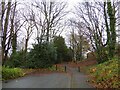
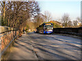
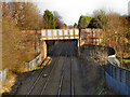
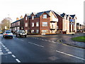

15 photos from this area
Area Information
Key information about the M23 9HB including its size, population, and administrative classification.
- Area Type
- Postcode
- Area Size
- 2.2 hectares
- Population
- 1620
- Population Density
- 4281 people/km²
House Prices in M23 9HB
21
Properties
£561,496
Average Sold Price
£159,950
Lowest Price
£830,000
Highest Price
Showing 21 properties
| Address | Type | Beds | Baths | Last Sale Price | Last Sale Date | |
|---|---|---|---|---|---|---|
| West Bay, 300 Brooklands Road, Sale, M23 9HB | Semi-detached | 4 | 1 | £715,000 | Nov 2025 | |
| 298 Brooklands Road, Sale, M23 9HB | Semi-detached | 4 | 2 | £670,000 | Feb 2025 | |
| 290 Brooklands Road, Sale, M23 9HB | Bungalow | 4 | 2 | £611,000 | Jul 2024 | |
| 318 Brooklands Road, Sale, M23 9HB | Semi-detached | 5 | 2 | £678,500 | Aug 2023 | |
| 312 Brooklands Road, Sale, M23 9HB | Semi-detached | 5 | - | £830,000 | Jan 2021 | |
| Clevedon, 308 Brooklands Road, Sale, M23 9HB | Detached | 7 | 3 | £680,000 | Jan 2020 | |
| 288 Brooklands Road, Sale, M23 9HB | Detached | 5 | - | £655,000 | Feb 2019 | |
| 294 Brooklands Road, Sale, M23 9HB | Bungalow | 3 | 2 | £475,000 | Jan 2019 | |
| 292 Brooklands Road, Sale, M23 9HB | Detached | 3 | - | £385,000 | Feb 2017 | |
| 306 Brooklands Road, Sale, M23 9HB | Detached | 4 | 3 | £625,000 | Feb 2016 |
Page 1 of 3
Energy Efficiency in M23 9HB
Amenities
Schools
| Rank | School | Type | Entry gender | Ages |
|---|
Explore more schools in this area
Go to Schools tabDemographics
Household Size
Family (3-5 people)
most common
Accommodation Type
Houses
most common
Tenure
80
majority
Ethnic Group
White
most common
Religion
N/A
most common
Household Composition
N/A
most common
Age
47
median
Adults (30-64 years)
most common
Household Deprivation
N/A
with no deprivation
NS-SEC
45
in Lower managerial occupations
Explore more demographic insights in this area
Go to Demographics tabPlanning
Planning Constraints
- Flood RiskPremium
- Ramsar Wetland SitesPremium
- Area of Outstanding Natural BeautyPremium
- Protected Nature ReservePremium
- Protected WoodlandPremium