Area Overview for M23 8SF
Photos of M23 8SF


Area Information
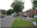
Living in M23 8SF means being part of a compact, residential community in England’s north-west. With a population of 1,550, this postcode area is small but well-served by nearby amenities and transport links. The area’s character is defined by its proximity to Manchester Airport, with easy access to rail stations and multiple metro hubs. Daily life here balances suburban tranquillity with urban connectivity, offering residents a mix of local shops, schools, and transport options. The community is predominantly composed of adults aged 30–64, reflecting a mature demographic. While the area lacks large-scale commercial developments, its strategic location near major infrastructure, including multiple railway stations and airport access points, makes it appealing for commuters and families. The low flood risk and absence of protected natural sites suggest a stable environment, though residents should be mindful of the area’s high crime risk. For those seeking a self-contained, low-maintenance lifestyle with access to key services, M23 8SF provides a pragmatic base.
- Area Type
- Postcode
- Area Size
- Not available
- Population
- 1550
- Population Density
- 1899 people/km²
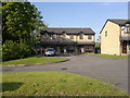
The property market in M23 8SF is characterised by a focus on houses, with no data on flats or other accommodation types. The 40% home ownership rate indicates that a majority of residents are likely to be renters, which may influence the types of properties available. Given the small size of the area, the housing stock is likely limited, with a concentration on individual homes rather than larger developments. This could mean that buyers seeking a property here may face competition for a limited number of homes, particularly if they are targeting specific types of housing. The absence of data on rental yields or property prices means the market’s dynamics remain unclear, but the emphasis on houses suggests a preference for standalone properties, which may appeal to families or those prioritising space.
House Prices in M23 8SF
No properties found in this postcode.
Energy Efficiency in M23 8SF
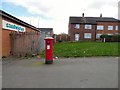
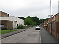
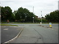
The lifestyle in M23 8SF is shaped by its proximity to retail, transport, and leisure facilities. Local shops such as Spar and M&S Wythenshawe provide essential amenities, while the Wythenshawe Town Centre offers a broader range of services. The area’s transport links, including rail stations and metro access, make it easy to reach larger cities or airports. For those seeking leisure, the presence of multiple metro hubs suggests access to parks, cafes, and other community spaces, though specific venues are not named in the data. The combination of retail, transport, and connectivity creates a functional lifestyle, where daily needs can be met without long commutes. The area’s small size means that amenities are concentrated, which could be a plus for those valuing convenience over expansive urban offerings.
Amenities
Schools
Residents of M23 8SF have access to three schools within practical reach. Newall Green High School serves as both a primary and academy, while Dixons Newall Green Academy is also an academy. These institutions provide a range of educational options, though the data does not include Ofsted ratings or academic performance metrics. The presence of two academies suggests a focus on structured, possibly specialist education, while the primary school caters to younger children. For families, this mix may offer flexibility in choosing between different teaching approaches or school cultures. However, the lack of additional schools or nurseries means the area’s educational infrastructure is limited to these three options.
| Rank | School | Type | Entry gender | Ages |
|---|
Explore more schools in this area
Go to Schools tabDemographics
The community in M23 8SF is largely composed of adults aged 30–64, with a median age of 47. This suggests a population skewed toward middle-aged individuals, many of whom may be in their peak earning years or nearing retirement. Home ownership rates stand at 40%, indicating that a significant proportion of residents rent their homes, which could reflect the area’s mix of older properties and its smaller size. The predominant ethnic group is White, with no data provided on other demographics. The absence of specific information on deprivation or diversity means the area’s social fabric remains largely unexplored in the data. However, the presence of schools and amenities suggests a functional, if modest, quality of life. The age profile implies a community with established routines, potentially prioritising stability over rapid change.
Household Size
Accommodation Type
Tenure
Ethnic Group
Religion
Household Composition
Age
Household Deprivation
NS-SEC
Explore more demographic insights in this area
Go to Demographics tabPlanning
Planning Constraints
- Flood RiskPremium
- Ramsar Wetland SitesPremium
- Area of Outstanding Natural BeautyPremium
- Protected Nature ReservePremium
- Protected WoodlandPremium