Area Overview for M23 1HH
Photos of M23 1HH
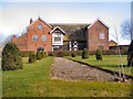
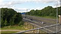
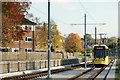
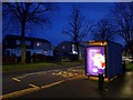

23 photos from this area
Area Information
Key information about the M23 1HH including its size, population, and administrative classification.
- Area Type
- Postcode
- Area Size
- 5365 m²
- Population
- 1735
- Population Density
- 5367 people/km²
House Prices in M23 1HH
19
Properties
£90,661
Average Sold Price
£30,000
Lowest Price
£154,500
Highest Price
Showing 19 properties
| Address | Type | Beds | Baths | Last Sale Price | Last Sale Date | |
|---|---|---|---|---|---|---|
| 4 Consett Avenue, Manchester, M23 1HH | house | - | - | £154,500 | Dec 2017 | |
| 7 Consett Avenue, Manchester, M23 1HH | Terraced | 3 | 1 | £115,000 | May 2015 | |
| 3 Consett Avenue, Manchester, M23 1HH | house | - | - | £100,000 | Dec 2012 | |
| 5 Consett Avenue, Manchester, M23 1HH | house | - | - | £90,500 | Sep 2010 | |
| 16 Consett Avenue, Manchester, M23 1HH | Terraced | 3 | 1 | £98,500 | Feb 2008 | |
| 12 Consett Avenue, Manchester, M23 1HH | Terraced | 3 | 1 | £95,000 | May 2007 | |
| 17 Consett Avenue, Manchester, M23 1HH | Terraced | - | - | £99,950 | Jan 2007 | |
| 8 Consett Avenue, Manchester, M23 1HH | Terraced | - | - | £32,500 | May 2001 | |
| 14 Consett Avenue, Manchester, M23 1HH | house | - | - | £30,000 | Feb 2001 | |
| 6 Consett Avenue, Manchester, M23 1HH | house | - | - | - | - |
Page 1 of 2
Energy Efficiency in M23 1HH
Amenities
Schools
| Rank | School | Type | Entry gender | Ages |
|---|
Explore more schools in this area
Go to Schools tabDemographics
Household Size
Family (3-5 people)
most common
Accommodation Type
Houses
most common
Tenure
43
majority
Ethnic Group
White
most common
Religion
N/A
most common
Household Composition
N/A
most common
Age
47
median
Adults (30-64 years)
most common
Household Deprivation
N/A
with no deprivation
NS-SEC
23
in Lower managerial occupations
Explore more demographic insights in this area
Go to Demographics tabPlanning
Planning Constraints
- Flood RiskPremium
- Ramsar Wetland SitesPremium
- Area of Outstanding Natural BeautyPremium
- Protected Nature ReservePremium
- Protected WoodlandPremium