Area Overview for M23 0PG
Photos of M23 0PG
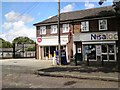
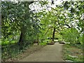
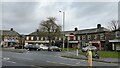
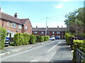
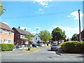
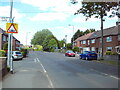

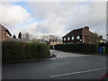
23 photos from this area
Area Information
Key information about the M23 0PG including its size, population, and administrative classification.
- Area Type
- Postcode
- Area Size
- 7218 m²
- Population
- 1898
- Population Density
- 5494 people/km²
House Prices in M23 0PG
24
Properties
£118,750
Average Sold Price
£36,000
Lowest Price
£227,000
Highest Price
Showing 24 properties
| Address | Type | Beds | Baths | Last Sale Price | Last Sale Date | |
|---|---|---|---|---|---|---|
| 152 Lawton Moor Road, Manchester, M23 0PG | Detached | 3 | 1 | £227,000 | Nov 2022 | |
| 150 Lawton Moor Road, Manchester, M23 0PG | Terraced | 3 | 1 | £150,000 | Oct 2018 | |
| 148 Lawton Moor Road, Manchester, M23 0PG | house | 3 | - | £149,000 | Jun 2017 | |
| 112 Lawton Moor Road, Manchester, M23 0PG | Semi-detached | - | - | £55,000 | Feb 2016 | |
| 138 Lawton Moor Road, Manchester, M23 0PG | house | - | - | £120,000 | Jan 2014 | |
| 146 Lawton Moor Road, Manchester, M23 0PG | house | 3 | - | £102,000 | Nov 2012 | |
| 120 Lawton Moor Road, Manchester, M23 0PG | house | - | - | £111,000 | Aug 2006 | |
| 122 Lawton Moor Road, Manchester, M23 0PG | Semi-detached | - | - | £36,000 | Mar 1998 | |
| 124 Lawton Moor Road, Manchester, M23 0PG | Detached | 4 | 1 | - | - | |
| 132 Lawton Moor Road, Manchester, M23 0PG | house | - | - | - | - |
Page 1 of 3
Energy Efficiency in M23 0PG
Amenities
Schools
| Rank | School | Type | Entry gender | Ages |
|---|
Explore more schools in this area
Go to Schools tabDemographics
Household Size
Family (3-5 people)
most common
Accommodation Type
Houses
most common
Tenure
53
majority
Ethnic Group
White
most common
Religion
N/A
most common
Household Composition
N/A
most common
Age
47
median
Adults (30-64 years)
most common
Household Deprivation
N/A
with no deprivation
NS-SEC
29
in Lower managerial occupations
Explore more demographic insights in this area
Go to Demographics tabPlanning
Planning Constraints
- Flood RiskPremium
- Ramsar Wetland SitesPremium
- Area of Outstanding Natural BeautyPremium
- Protected Nature ReservePremium
- Protected WoodlandPremium