Area Overview for M23 0GQ
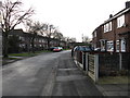
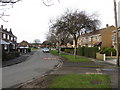
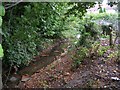
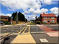
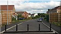
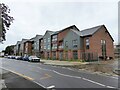
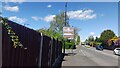
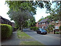
Photos of M23 0GQ


Area Information
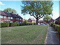
Living in M23 0GQ means being part of a small, tightly knit residential cluster in England. With a population of 1,785, this area is compact but offers a mix of practical living and accessible amenities. The community is predominantly composed of adults aged 30–64, reflecting a mature demographic profile. Daily life here is shaped by proximity to retail hubs, transport links, and green spaces. The area’s broadband score of 99 ensures seamless internet connectivity, while nearby rail stations and airports provide easy access to regional and national travel. However, the high crime risk score—0 out of 100—means residents should consider security measures. Despite this, the absence of environmental constraints like protected woodlands or Ramsar sites makes it a straightforward area for development and living. Its small size means the character of M23 0GQ is defined by its immediate surroundings, blending suburban comfort with practical infrastructure.
- Area Type
- Postcode
- Area Size
- Not available
- Population
- 1785
- Population Density
- 6484 people/km²
The property market in M23 0GQ is characterised by a mix of owner-occupied and rented homes, with 43% of properties owned by residents. The accommodation type is predominantly houses, which is unusual for a small postcode area but may indicate a focus on family homes or larger properties. This suggests the area is not a high-density rental market but rather a blend of private ownership and tenancy. Buyers should note that the limited size of the postcode means the housing stock is finite, and availability may be constrained. The presence of houses rather than flats or apartments could appeal to those seeking space or privacy. However, the low home ownership rate implies competition for properties, particularly among first-time buyers or investors. Proximity to transport links and retail amenities may enhance the area’s desirability, though the high crime risk could deter some buyers.
House Prices in M23 0GQ
No properties found in this postcode.
Energy Efficiency in M23 0GQ
Residents of M23 0GQ have access to a range of amenities within walking or short driving distance. Retail options include five supermarkets, such as Tesco Northern and Morrisons, ensuring everyday shopping needs are met. Parks and open spaces like Wythenshawe Park and Northern Moor offer recreational opportunities, while nearby rail stations—Navigation Road, Altrincham, and Gatley—provide easy access to urban centres. Airports are also within reach, with Terminal One, Two, and Three accessible for travel. The area’s proximity to Moor Road and other local landmarks suggests a mix of residential and light commercial activity. This blend of green spaces, retail, and transport infrastructure creates a balanced lifestyle, combining suburban tranquility with urban connectivity. The presence of multiple rail stations and airports also makes it a practical choice for those requiring frequent travel.
Amenities
Schools
| Rank | School | Type | Entry gender | Ages |
|---|
Explore more schools in this area
Go to Schools tabDemographics
The population of M23 0GQ is 1,785, with a median age of 47 and the majority of residents falling within the 30–64 age range. This suggests a community of established adults, likely with families or long-term careers. Home ownership stands at 43%, indicating that nearly half of properties are rented, which may influence the area’s social dynamics. The predominant accommodation type is houses, reflecting a traditional suburban layout. The predominant ethnic group is White, though no specific data on diversity or deprivation is provided. The age profile suggests a stable, low-turnover population, with fewer young families or retirees. This demographic structure may impact local services and amenities, as the needs of middle-aged residents—such as reliable transport and healthcare access—are prioritised.
Household Size
Accommodation Type
Tenure
Ethnic Group
Religion
Household Composition
Age
Household Deprivation
NS-SEC
Explore more demographic insights in this area
Go to Demographics tabPlanning
Planning Constraints
- Flood RiskPremium
- Ramsar Wetland SitesPremium
- Area of Outstanding Natural BeautyPremium
- Protected Nature ReservePremium
- Protected WoodlandPremium