Area Overview for M22 5WL
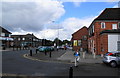
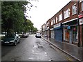
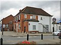
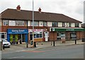
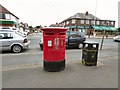
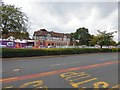
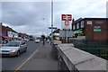
Photos of M22 5WL


Area Information
Living in M22 5WL means inhabiting a compact, residential cluster in England, where 2020 residents occupy 1.5 hectares of land. The area’s population density of 1,029 people per square kilometre reflects a tightly knit community, though its small size means it is not a sprawling suburb. This postcode is characterised by a mature demographic, with a median age of 47 and most residents falling within the 30-64 age range. Daily life here is shaped by proximity to transport hubs, including five railway stations such as Heald Green and Styal, and direct access to Manchester Airport. The area’s broadband score of 100 ensures seamless digital connectivity, though mobile coverage is slightly lower at 85. While flood risk is negligible, safety concerns persist, as highlighted by the critical crime risk rating. Despite its challenges, M22 5WL offers a blend of practicality and accessibility, with homes primarily in owner-occupied properties and a focus on houses rather than flats. For buyers, the area’s compactness means amenities and transport are within easy reach, but the high crime score demands careful consideration.
- Area Type
- Postcode
- Area Size
- 1.5 hectares
- Population
- 2020
- Population Density
- 1029 people/km²
The property market in M22 5WL is defined by a 44% home ownership rate, with houses making up the majority of accommodation types. This suggests a market skewed towards owner-occupied properties rather than rental or leasehold flats. Given the area’s small size of 1.5 hectares, the housing stock is likely limited, with properties concentrated in a compact cluster. Buyers should consider that the area’s proximity to transport hubs, including five railway stations and Manchester Airport, may influence property values. However, the high crime risk rating could affect desirability, though this is not reflected in the data on property prices or demand. For those seeking homes, the focus on houses rather than flats means buyers may find fewer options for modern or converted properties. The immediate surroundings, while not detailed in the data, may offer similar characteristics, given the area’s small scale.
House Prices in M22 5WL
Showing 1 properties
| Address | Type | Beds | Baths | Last Sale Price | Last Sale Date | |
|---|---|---|---|---|---|---|
| Renold House, Styal Road, Manchester, M22 5WL | office_workshop | - | - | - | - |
Energy Efficiency in M22 5WL
Daily life in M22 5WL is shaped by its proximity to retail and transport hubs. Within reach are five retail outlets, including Co-op Heald and Morrisons Daily, providing essential shopping options. The area’s railway stations connect residents to broader networks, while Manchester Airport offers international travel convenience. Metro stations such as Shadowmoss and Robinswood Road add to the area’s accessibility, enabling quick trips to leisure or cultural venues. Though the data does not specify parks or recreational spaces, the absence of protected natural areas suggests limited green spaces. The compact layout means amenities are within walking or short driving distance, fostering a practical lifestyle. However, the reliance on rail and metro links may limit spontaneity for those without access to public transport. The combination of retail, transport, and proximity to airports creates a functional environment, though the lack of detailed information on leisure facilities leaves gaps in understanding the area’s full character.
Amenities
Schools
| Rank | School | Type | Entry gender | Ages |
|---|
Explore more schools in this area
Go to Schools tabDemographics
The community in M22 5WL is predominantly composed of adults aged 30-64, with a median age of 47. This suggests a stable, established population, likely with long-term ties to the area. Home ownership stands at 44%, indicating a mix of owner-occupied and rental properties, though the data does not specify the latter’s proportion. The accommodation type is largely houses, which contrasts with areas dominated by flats or apartments. The predominant ethnic group is White, though no further breakdown of diversity is provided. The population density of 1,029 people per square kilometre implies a relatively tight-knit environment, where social interactions may be frequent. However, the lack of specific data on deprivation or income levels means the area’s economic profile remains unclear. For residents, the demographic profile suggests a community focused on stability and family life, with limited evidence of transient populations or younger households.
Household Size
Accommodation Type
Tenure
Ethnic Group
Religion
Household Composition
Age
Household Deprivation
NS-SEC
Explore more demographic insights in this area
Go to Demographics tabPlanning
Planning Constraints
- Flood RiskPremium
- Ramsar Wetland SitesPremium
- Area of Outstanding Natural BeautyPremium
- Protected Nature ReservePremium
- Protected WoodlandPremium