Area Overview for M22 5RX
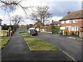
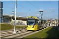
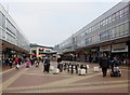
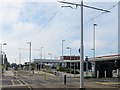
Photos of M22 5RX


Area Information
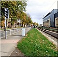
M22 5RX is a compact residential cluster in England, spanning just 1.7 hectares and home to 1,481 people. The area’s high population density—89,631 people per square kilometre—suggests a tightly knit community, though its small size means it is more of a micro-locale than a sprawling suburb. The area is characterised by a mature demographic, with a median age of 47 and the majority of residents falling within the 30–64 age bracket. This reflects a stable, established population, likely comprising long-term residents and families. The area’s proximity to key transport hubs, including Manchester Airport and several railway stations, makes it appealing for commuters, while its limited size means it is best suited for those prioritising convenience over expansive living space. The presence of nearby amenities such as retail outlets, metro areas, and airports ensures daily life is well-supported, though the area’s small footprint means it is more of a functional node than a standalone neighbourhood.
- Area Type
- Postcode
- Area Size
- 1.7 hectares
- Population
- 1481
- Population Density
- 3638 people/km²
The property market in M22 5RX is defined by a low home ownership rate (25%) and a predominance of houses. This suggests a mix of rental properties and owner-occupied homes, though the small area size means the housing stock is limited. The presence of houses may indicate a focus on family homes or semi-detached properties, but the lack of data on property types or prices means it is unclear whether this is a high-end or affordable market. Buyers should consider the area’s compact nature, which may restrict options for larger homes or development. The low ownership rate could imply a reliance on rental markets or shared ownership schemes, though the exact dynamics are not specified. For those seeking a small, functional home near transport links, M22 5RX may offer convenience, but its limited size means buyers should prioritise proximity to nearby amenities over property size.
House Prices in M22 5RX
Showing 1 properties
| Address | Type | Beds | Baths | Last Sale Price | Last Sale Date | |
|---|---|---|---|---|---|---|
| Peel Hall Medical Practice, Forum Health, Simonsway, Manchester, M22 5RX | commercial | - | - | - | - |
Energy Efficiency in M22 5RX
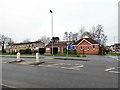
Residents of M22 5RX have access to a range of amenities within walking or short driving distance. The area’s proximity to Wythenshawe Town Centre, Robinswood Road, and Crossacres provides opportunities for shopping, dining, and leisure. Retail options include Iceland Wythenshawe, Farmfoods Peel, and Heron Peel, catering to everyday needs. The presence of multiple railway stations and airport access enhances connectivity, making it easy to travel further afield. While the area lacks large parks or recreational spaces, the nearby metro areas may offer green spaces or community facilities. The compact nature of M22 5RX means daily life is efficient, with amenities clustered closely, though residents may need to venture beyond the area for more extensive leisure or cultural options.
Amenities
Schools
The only school listed near M22 5RX is Gresty Nursery School, which provides early years education. No primary or secondary schools are mentioned in the data, which may be a limitation for families requiring a full range of educational options. The absence of higher-level schools suggests that residents may need to travel to nearby areas for primary or secondary education. For parents relying on nursery care, Gresty Nursery School offers a local solution, though its Ofsted rating is not provided. The lack of detailed information on school quality or availability means prospective buyers should investigate further to assess whether the area meets their children’s educational needs.
| Rank | School | Type | Entry gender | Ages |
|---|
Explore more schools in this area
Go to Schools tabDemographics
The population of M22 5RX is predominantly composed of adults aged 30–64, with a median age of 47. This suggests a community of established professionals, families, and retirees, with fewer younger or elderly residents. Home ownership in the area is relatively low at 25%, indicating a higher proportion of renters compared to owner-occupiers. The accommodation type is primarily houses, which may reflect a mix of semi-detached or terraced properties. The predominant ethnic group is White, though specific data on diversity or deprivation is not provided. The high population density—89,631 people per square kilometre—suggests a compact, possibly urbanised setting, though the area’s small size (1.7 hectares) implies a tightly packed residential layout. This density could influence local services and infrastructure, with demand for amenities like schools and transport being critical to quality of life.
Household Size
Accommodation Type
Tenure
Ethnic Group
Religion
Household Composition
Age
Household Deprivation
NS-SEC
Explore more demographic insights in this area
Go to Demographics tabPlanning
Planning Constraints
- Flood RiskPremium
- Ramsar Wetland SitesPremium
- Area of Outstanding Natural BeautyPremium
- Protected Nature ReservePremium
- Protected WoodlandPremium