Area Overview for M22 4WD
Photos of M22 4WD

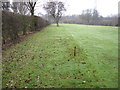
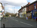
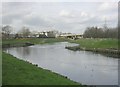
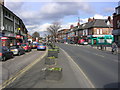
77 photos from this area
Area Information
Key information about the M22 4WD including its size, population, and administrative classification.
- Area Type
- Postcode
- Area Size
- 2596 m²
- Population
- 2187
- Population Density
- 2655 people/km²
House Prices in M22 4WD
16
Properties
£173,896
Average Sold Price
£36,000
Lowest Price
£300,000
Highest Price
Showing 16 properties
| Address | Type | Beds | Baths | Last Sale Price | Last Sale Date | |
|---|---|---|---|---|---|---|
| 55A Church Road, Manchester, M22 4WD | house | - | - | £199,000 | Dec 2025 | |
| 61 Church Road, Manchester, M22 4WD | Terraced | 3 | 1 | £285,000 | Dec 2024 | |
| 69 Church Road, Manchester, M22 4WD | house | - | - | £142,000 | Nov 2023 | |
| 75 Church Road, Manchester, M22 4WD | Semi-detached | 4 | 2 | £36,000 | Oct 2021 | |
| 57 Church Road, Manchester, M22 4WD | Terraced | 4 | 3 | £250,000 | Jun 2021 | |
| 67A Church Road, Manchester, M22 4WD | Flat | 2 | 1 | £187,000 | Aug 2019 | |
| Flat Above, 71 Church Road, Manchester, M22 4WD | retail_financial | - | - | £157,000 | May 2019 | |
| 59 Church Road, Manchester, M22 4WD | Terraced | 3 | 1 | £160,750 | Feb 2017 | |
| 79 Church Road, Manchester, M22 4WD | house | - | - | £300,000 | Sep 2015 | |
| 55 Church Road, Manchester, M22 4WD | Terraced | 3 | 1 | £80,000 | Aug 2008 |
Page 1 of 2
Energy Efficiency in M22 4WD
Amenities
Schools
| Rank | School | Type | Entry gender | Ages |
|---|
Explore more schools in this area
Go to Schools tabDemographics
Household Size
One person
most common
Accommodation Type
Houses
most common
Tenure
66
majority
Ethnic Group
White
most common
Religion
N/A
most common
Household Composition
N/A
most common
Age
47
median
Adults (30-64 years)
most common
Household Deprivation
N/A
with no deprivation
NS-SEC
47
in Lower managerial occupations
Explore more demographic insights in this area
Go to Demographics tabPlanning
Planning Constraints
- Flood RiskPremium
- Ramsar Wetland SitesPremium
- Area of Outstanding Natural BeautyPremium
- Protected Nature ReservePremium
- Protected WoodlandPremium