Area Overview for M22 4BS
Photos of M22 4BS
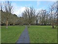
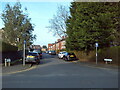
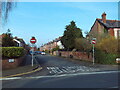
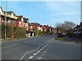
27 photos from this area
Area Information
Key information about the M22 4BS including its size, population, and administrative classification.
- Area Type
- Postcode
- Area Size
- 3.3 hectares
- Population
- 1534
- Population Density
- 2579 people/km²
House Prices in M22 4BS
20
Properties
£440,903
Average Sold Price
£159,950
Lowest Price
£665,000
Highest Price
Showing 20 properties
| Address | Type | Beds | Baths | Last Sale Price | Last Sale Date | |
|---|---|---|---|---|---|---|
| 34 Gibwood Road, Manchester, M22 4BS | Detached | 4 | 2 | £635,000 | Jul 2025 | |
| 54 Gibwood Road, Manchester, M22 4BS | Detached | 4 | 2 | £665,000 | Aug 2024 | |
| 38 Gibwood Road, Manchester, M22 4BS | house | - | - | £499,500 | Nov 2021 | |
| 50 Gibwood Road, Manchester, M22 4BS | house | - | - | £555,000 | Jun 2021 | |
| 42 Gibwood Road, Manchester, M22 4BS | house | - | - | £480,000 | Nov 2020 | |
| 40 Gibwood Road, Manchester, M22 4BS | Detached | 4 | 2 | £495,000 | Jun 2020 | |
| 46 Gibwood Road, Manchester, M22 4BS | Detached | 5 | 2 | £460,000 | Feb 2018 | |
| 53 Gibwood Road, Manchester, M22 4BS | Detached | 4 | 2 | £422,000 | May 2016 | |
| 59 Gibwood Road, Manchester, M22 4BS | house | - | - | £535,000 | Dec 2015 | |
| 60 Gibwood Road, Manchester, M22 4BS | house | - | - | £432,000 | Nov 2014 |
Page 1 of 2
Energy Efficiency in M22 4BS
Amenities
Schools
| Rank | School | Type | Entry gender | Ages |
|---|
Explore more schools in this area
Go to Schools tabDemographics
Household Size
Family (3-5 people)
most common
Accommodation Type
Houses
most common
Tenure
77
majority
Ethnic Group
White
most common
Religion
N/A
most common
Household Composition
N/A
most common
Age
47
median
Adults (30-64 years)
most common
Household Deprivation
N/A
with no deprivation
NS-SEC
37
in Lower managerial occupations
Explore more demographic insights in this area
Go to Demographics tabPlanning
Planning Constraints
- Flood RiskPremium
- Ramsar Wetland SitesPremium
- Area of Outstanding Natural BeautyPremium
- Protected Nature ReservePremium
- Protected WoodlandPremium