Area Overview for M22 0LS
Photos of M22 0LS
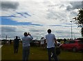
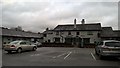
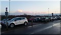
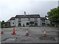
76 photos from this area
Area Information
Key information about the M22 0LS including its size, population, and administrative classification.
- Area Type
- Postcode
- Area Size
- 1.5 hectares
- Population
- 2020
- Population Density
- 1029 people/km²
House Prices in M22 0LS
26
Properties
£151,544
Average Sold Price
£18,200
Lowest Price
£260,000
Highest Price
Showing 26 properties
| Address | Type | Beds | Baths | Last Sale Price | Last Sale Date | |
|---|---|---|---|---|---|---|
| 45 Carsdale Road, Manchester, M22 0LS | Terraced | 3 | 1 | £235,000 | Jul 2024 | |
| 33 Carsdale Road, Manchester, M22 0LS | house | - | - | £195,000 | Mar 2024 | |
| 23 Carsdale Road, Manchester, M22 0LS | Terraced | 3 | 1 | £260,000 | Oct 2022 | |
| 24 Carsdale Road, Manchester, M22 0LS | house | - | - | £188,000 | Nov 2021 | |
| 44 Carsdale Road, Manchester, M22 0LS | Semi-detached | 3 | 1 | £168,750 | Mar 2019 | |
| 27 Carsdale Road, Manchester, M22 0LS | Terraced | 3 | - | £94,000 | Jun 2007 | |
| 46 Carsdale Road, Manchester, M22 0LS | house | - | - | £99,950 | Sep 2004 | |
| 36 Carsdale Road, Manchester, M22 0LS | house | - | - | £105,000 | Mar 2004 | |
| 29 Carsdale Road, Manchester, M22 0LS | Semi-detached | - | - | £18,200 | Sep 1999 | |
| 34 Carsdale Road, Manchester, M22 0LS | house | 3 | 1 | - | - |
Page 1 of 3
Energy Efficiency in M22 0LS
Amenities
Schools
| Rank | School | Type | Entry gender | Ages |
|---|
Explore more schools in this area
Go to Schools tabDemographics
Household Size
One person
most common
Accommodation Type
Houses
most common
Tenure
44
majority
Ethnic Group
White
most common
Religion
N/A
most common
Household Composition
N/A
most common
Age
47
median
Adults (30-64 years)
most common
Household Deprivation
N/A
with no deprivation
NS-SEC
24
in Lower managerial occupations
Explore more demographic insights in this area
Go to Demographics tabPlanning
Planning Constraints
- Flood RiskPremium
- Ramsar Wetland SitesPremium
- Area of Outstanding Natural BeautyPremium
- Protected Nature ReservePremium
- Protected WoodlandPremium