Area Overview for M21 9QJ
Photos of M21 9QJ
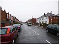
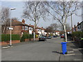
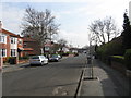
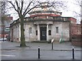

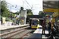
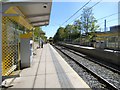
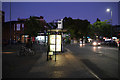
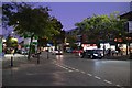
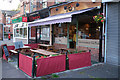

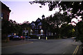
70 photos from this area
Area Information
Key information about the M21 9QJ including its size, population, and administrative classification.
- Area Type
- Postcode
- Area Size
- 3228 m²
- Population
- 1610
- Population Density
- 6545 people/km²
House Prices in M21 9QJ
20
Properties
£305,208
Average Sold Price
£42,000
Lowest Price
£515,000
Highest Price
Showing 20 properties
| Address | Type | Beds | Baths | Last Sale Price | Last Sale Date | |
|---|---|---|---|---|---|---|
| 24 Kensington Road, Manchester, M21 9QJ | Terraced | 3 | 1 | £476,500 | Dec 2025 | |
| 4 Kensington Road, Manchester, M21 9QJ | Terraced | 3 | 1 | £470,000 | Jun 2025 | |
| 14 Kensington Road, Manchester, M21 9QJ | Terraced | 3 | 1 | £515,000 | Jul 2024 | |
| 16 Kensington Road, Manchester, M21 9QJ | Terraced | 3 | 1 | £480,000 | Jun 2024 | |
| 28 Kensington Road, Manchester, M21 9QJ | Terraced | 3 | 1 | £468,000 | Nov 2022 | |
| 22 Kensington Road, Manchester, M21 9QJ | house | 3 | - | £285,000 | Dec 2015 | |
| 34 Kensington Road, Manchester, M21 9QJ | house | - | - | £259,000 | Jan 2015 | |
| 10 Kensington Road, Manchester, M21 9QJ | house | - | - | £250,000 | Dec 2014 | |
| 38 Kensington Road, Manchester, M21 9QJ | Terraced | - | - | £248,000 | Aug 2007 | |
| 36 Kensington Road, Manchester, M21 9QJ | Terraced | - | - | £105,000 | Aug 2001 |
Page 1 of 2
Energy Efficiency in M21 9QJ
Amenities
Schools
| Rank | School | Type | Entry gender | Ages |
|---|
Explore more schools in this area
Go to Schools tabDemographics
Household Size
Family (3-5 people)
most common
Accommodation Type
Houses
most common
Tenure
67
majority
Ethnic Group
White
most common
Religion
N/A
most common
Household Composition
N/A
most common
Age
47
median
Adults (30-64 years)
most common
Household Deprivation
N/A
with no deprivation
NS-SEC
56
in Lower managerial occupations
Explore more demographic insights in this area
Go to Demographics tabPlanning
Planning Constraints
- Flood RiskPremium
- Ramsar Wetland SitesPremium
- Area of Outstanding Natural BeautyPremium
- Protected Nature ReservePremium
- Protected WoodlandPremium