Area Overview for M21 9NL
Photos of M21 9NL
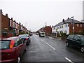
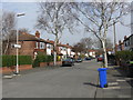
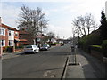


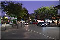
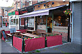


70 photos from this area
Area Information
Key information about the M21 9NL including its size, population, and administrative classification.
- Area Type
- Postcode
- Area Size
- 4863 m²
- Population
- 1436
- Population Density
- 7622 people/km²
House Prices in M21 9NL
17
Properties
£325,723
Average Sold Price
£53,000
Lowest Price
£535,200
Highest Price
Showing 17 properties
| Address | Type | Beds | Baths | Last Sale Price | Last Sale Date | |
|---|---|---|---|---|---|---|
| 15 Oswald Road, Manchester, M21 9NL | Terraced | 4 | 2 | £487,750 | Dec 2025 | |
| 37 Oswald Road, Manchester, M21 9NL | house | - | - | £355,000 | Apr 2023 | |
| 19 Oswald Road, Manchester, M21 9NL | house | - | - | £510,000 | Sep 2021 | |
| 17 Oswald Road, Manchester, M21 9NL | Terraced | 4 | 2 | £535,200 | Mar 2021 | |
| 35 Oswald Road, Manchester, M21 9NL | Terraced | 3 | 1 | £328,000 | Aug 2018 | |
| 29 Oswald Road, Manchester, M21 9NL | Terraced | - | - | £406,000 | Sep 2015 | |
| 33 Oswald Road, Manchester, M21 9NL | house | - | - | £230,000 | Nov 2013 | |
| 25 Oswald Road, Manchester, M21 9NL | Terraced | 4 | - | £378,000 | Jul 2013 | |
| 13 Oswald Road, Manchester, M21 9NL | Terraced | - | - | £205,000 | Oct 2003 | |
| 27 Oswald Road, Manchester, M21 9NL | house | - | - | £95,000 | Feb 2000 |
Page 1 of 2
Energy Efficiency in M21 9NL
Amenities
Schools
| Rank | School | Type | Entry gender | Ages |
|---|
Explore more schools in this area
Go to Schools tabDemographics
Household Size
Family (3-5 people)
most common
Accommodation Type
Houses
most common
Tenure
82
majority
Ethnic Group
White
most common
Religion
N/A
most common
Household Composition
N/A
most common
Age
47
median
Adults (30-64 years)
most common
Household Deprivation
N/A
with no deprivation
NS-SEC
64
in Lower managerial occupations
Explore more demographic insights in this area
Go to Demographics tabPlanning
Planning Constraints
- Flood RiskPremium
- Ramsar Wetland SitesPremium
- Area of Outstanding Natural BeautyPremium
- Protected Nature ReservePremium
- Protected WoodlandPremium