Area Overview for M21 9LA
Photos of M21 9LA
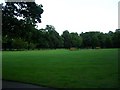

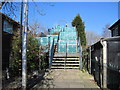
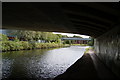
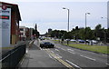
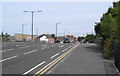
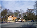
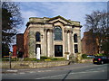
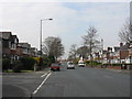

66 photos from this area
Area Information
Key information about the M21 9LA including its size, population, and administrative classification.
- Area Type
- Postcode
- Area Size
- 1.4 hectares
- Population
- 1476
- Population Density
- 7756 people/km²
House Prices in M21 9LA
26
Properties
£259,434
Average Sold Price
£950
Lowest Price
£440,000
Highest Price
Showing 26 properties
| Address | Type | Beds | Baths | Last Sale Price | Last Sale Date | |
|---|---|---|---|---|---|---|
| 1B Hampton Road, Manchester, M21 9LA | Semi-detached | 3 | 1 | £405,000 | Sep 2023 | |
| 32 Hampton Road, Manchester, M21 9LA | house | - | - | £380,000 | Jan 2022 | |
| 23 Hampton Road, Manchester, M21 9LA | house | - | - | £440,000 | Dec 2021 | |
| 17 Hampton Road, Manchester, M21 9LA | house | - | - | £340,000 | Oct 2018 | |
| 30 Hampton Road, Manchester, M21 9LA | house | - | - | £950 | Jun 2018 | |
| 14 Hampton Road, Manchester, M21 9LA | house | - | - | £325,000 | Oct 2015 | |
| 10 Hampton Road, Manchester, M21 9LA | Detached | 3 | - | £308,000 | Oct 2015 | |
| 25 Hampton Road, Manchester, M21 9LA | house | - | - | £275,000 | Aug 2015 | |
| 19 Hampton Road, Manchester, M21 9LA | house | - | - | £285,000 | May 2015 | |
| 1 Hampton Road, Manchester, M21 9LA | house | 4 | - | £425,500 | May 2014 |
Page 1 of 3
Energy Efficiency in M21 9LA
Amenities
Schools
| Rank | School | Type | Entry gender | Ages |
|---|
Explore more schools in this area
Go to Schools tabDemographics
Household Size
One person
most common
Accommodation Type
Flats
most common
Tenure
50
majority
Ethnic Group
White
most common
Religion
N/A
most common
Household Composition
N/A
most common
Age
47
median
Adults (30-64 years)
most common
Household Deprivation
N/A
with no deprivation
NS-SEC
49
in Lower managerial occupations
Explore more demographic insights in this area
Go to Demographics tabPlanning
Planning Constraints
- Flood RiskPremium
- Ramsar Wetland SitesPremium
- Area of Outstanding Natural BeautyPremium
- Protected Nature ReservePremium
- Protected WoodlandPremium