Area Overview for M21 9FX
Photos of M21 9FX
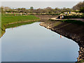
![River Mersey, looking downstream [north] in M21 9FX](https://images.propbar.co.uk/images/geograph/43/50/4350045_120.jpg)


40 photos from this area
Area Information
Key information about the M21 9FX including its size, population, and administrative classification.
- Area Type
- Postcode
- Area Size
- 26.3 hectares
- Population
- 1434
- Population Density
- 3814 people/km²
House Prices in M21 9FX
25
Properties
£212,720
Average Sold Price
£53,500
Lowest Price
£560,000
Highest Price
Showing 25 properties
| Address | Type | Beds | Baths | Last Sale Price | Last Sale Date | |
|---|---|---|---|---|---|---|
| 119 Ivygreen Road, Manchester, M21 9FX | Semi-detached | 3 | 3 | £560,000 | Feb 2025 | |
| 101 Ivygreen Road, Manchester, M21 9FX | Terraced | 3 | 1 | £395,000 | Nov 2019 | |
| 114 Ivygreen Road, Manchester, M21 9FX | Semi-detached | 3 | 1 | £305,000 | Apr 2016 | |
| 130 Ivygreen Road, Manchester, M21 9FX | house | 4 | 2 | £244,000 | May 2015 | |
| 105 Ivygreen Road, Manchester, M21 9FX | Terraced | - | - | £160,000 | Aug 2012 | |
| 110 Ivygreen Road, Manchester, M21 9FX | house | 3 | - | £259,750 | Jul 2012 | |
| 99 Ivygreen Road, Manchester, M21 9FX | house | - | - | £233,000 | May 2009 | |
| 115 Ivygreen Road, Manchester, M21 9FX | Semi-detached | - | - | £167,500 | Nov 2006 | |
| 117 Ivygreen Road, Manchester, M21 9FX | Semi-detached | - | - | £180,800 | Aug 2006 | |
| 118 Ivygreen Road, Manchester, M21 9FX | house | 3 | 1 | £193,750 | Jul 2006 |
Page 1 of 3
Energy Efficiency in M21 9FX
Amenities
Schools
| Rank | School | Type | Entry gender | Ages |
|---|
Explore more schools in this area
Go to Schools tabDemographics
Household Size
Two person
most common
Accommodation Type
Houses
most common
Tenure
73
majority
Ethnic Group
White
most common
Religion
N/A
most common
Household Composition
N/A
most common
Age
47
median
Adults (30-64 years)
most common
Household Deprivation
N/A
with no deprivation
NS-SEC
64
in Lower managerial occupations
Explore more demographic insights in this area
Go to Demographics tabPlanning
Planning Constraints
- Flood RiskPremium
- Ramsar Wetland SitesPremium
- Area of Outstanding Natural BeautyPremium
- Protected Nature ReservePremium
- Protected WoodlandPremium