Area Overview for M21 9FN
Photos of M21 9FN
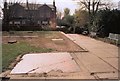

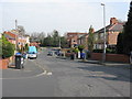


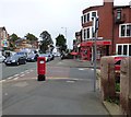
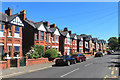
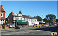
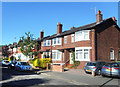
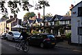

74 photos from this area
Area Information
Key information about the M21 9FN including its size, population, and administrative classification.
- Area Type
- Postcode
- Area Size
- 4942 m²
- Population
- 1529
- Population Density
- 1716 people/km²
House Prices in M21 9FN
17
Properties
£378,330
Average Sold Price
£168,000
Lowest Price
£565,000
Highest Price
Showing 17 properties
| Address | Type | Beds | Baths | Last Sale Price | Last Sale Date | |
|---|---|---|---|---|---|---|
| 29 Belwood Road, Manchester, M21 9FN | Semi-detached | 3 | 1 | £540,000 | Jul 2022 | |
| 14 Belwood Road, Manchester, M21 9FN | house | - | - | £565,000 | Dec 2021 | |
| 21 Belwood Road, Manchester, M21 9FN | house | - | - | £483,500 | May 2020 | |
| 17 Belwood Road, Manchester, M21 9FN | Semi-detached | 4 | 2 | £392,000 | Oct 2016 | |
| 23 Belwood Road, Manchester, M21 9FN | house | - | - | £420,000 | Apr 2016 | |
| 28 Belwood Road, Manchester, M21 9FN | house | - | - | £359,800 | Mar 2016 | |
| 20 Belwood Road, Manchester, M21 9FN | house | - | - | £295,000 | Jul 2011 | |
| 19 Belwood Road, Manchester, M21 9FN | house | - | - | £275,000 | Apr 2010 | |
| 25 Belwood Road, Manchester, M21 9FN | house | - | - | £285,000 | Apr 2010 | |
| 30 Belwood Road, Manchester, M21 9FN | Semi-detached | - | - | £168,000 | Jul 2003 |
Page 1 of 2
Energy Efficiency in M21 9FN
Amenities
Schools
| Rank | School | Type | Entry gender | Ages |
|---|
Explore more schools in this area
Go to Schools tabDemographics
Household Size
Family (3-5 people)
most common
Accommodation Type
Houses
most common
Tenure
87
majority
Ethnic Group
White
most common
Religion
N/A
most common
Household Composition
N/A
most common
Age
47
median
Adults (30-64 years)
most common
Household Deprivation
N/A
with no deprivation
NS-SEC
64
in Lower managerial occupations
Explore more demographic insights in this area
Go to Demographics tabPlanning
Planning Constraints
- Flood RiskPremium
- Ramsar Wetland SitesPremium
- Area of Outstanding Natural BeautyPremium
- Protected Nature ReservePremium
- Protected WoodlandPremium