Area Overview for M21 9BF
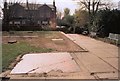
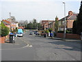
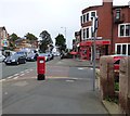
Photos of M21 9BF


Area Information
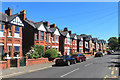
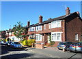
Living in M21 9BF offers a quiet, residential experience within a small cluster of homes. With a population of 1,434, the area is compact but well-served by essential services. The community is predominantly composed of adults aged 30–64, reflecting a mature demographic that leans towards home ownership. Over 73% of residents own their homes, many of which are traditional houses rather than flats, suggesting a stable, long-term presence. The area’s proximity to Chorlton CofE Primary School, rated outstanding by Ofsted, makes it appealing for families. Nearby, residents have access to multiple railway stations, including Trafford Park and Manchester United FC, as well as Co-op stores and retail hubs. While the area is small, its connectivity to major transport routes and proximity to Manchester’s urban amenities create a balance between seclusion and accessibility. For those seeking a low-flood-risk environment with minimal planning constraints, M21 9BF is a practical choice, though crime rates here are notably higher than average, requiring vigilance.
- Area Type
- Postcode
- Area Size
- Not available
- Population
- 1434
- Population Density
- 3814 people/km²
The property market in M21 9BF is characterised by a high rate of home ownership (73%) and a focus on houses rather than flats or apartments. This suggests a residential area with limited rental activity, likely catering to owner-occupiers seeking long-term stability. The predominance of houses may indicate larger properties, which could appeal to families or those prioritising space. However, the small size of the area means the housing stock is limited, and buyers may need to look beyond immediate surroundings for more options. The absence of newer developments or commercial properties implies a traditional, possibly older housing stock. For those considering purchase, the market’s compact nature means competition could be fierce, but the lack of planning constraints and low flood risk may offset concerns about environmental hazards.
House Prices in M21 9BF
No properties found in this postcode.
Energy Efficiency in M21 9BF
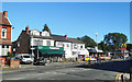
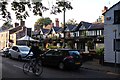
Daily life in M21 9BF is shaped by its proximity to retail, transport, and leisure facilities. The area includes five retail outlets, such as Co-op Chorlton and M&S Chorlton-Cum, providing access to groceries, clothing, and other essentials. Nearby, residents can reach Sale Water Park, a recreational space, and multiple railway stations, including Trafford Park and Humphrey Park, which connect to Manchester’s broader network. The presence of Manchester United FC Railway Station highlights the area’s ties to local culture and events. Airports like City Airport Manchester are within reach, facilitating travel. The mix of retail, transport, and green spaces offers convenience for both daily errands and leisure, though the small size of the area means some amenities may require a short journey.
Amenities
Schools
The nearest school to M21 9BF is Chorlton CofE Primary School, a primary institution with an outstanding Ofsted rating. This school serves the local community, offering education for younger children in a setting that has been recognised for its quality. The presence of a single primary school suggests that families in the area may need to travel further for secondary education, though the school’s high rating indicates strong foundational learning. The absence of secondary schools in the immediate vicinity means parents should consider proximity to other educational institutions when evaluating the area. For those prioritising primary education, the outstanding rating at Chorlton CofE Primary School is a significant advantage.
| Rank | School | Type | Entry gender | Ages |
|---|
Explore more schools in this area
Go to Schools tabDemographics
The population of M21 9BF is 1,434, with a median age of 47, indicating a community skewed towards middle-aged and older adults. The most common age range is 30–64 years, suggesting a mix of working-age individuals and retirees. Home ownership is strong, with 73% of residents owning their homes, compared to 27% renting. The accommodation type is predominantly houses, reflecting a suburban or semi-rural character. The predominant ethnic group is White, which aligns with broader regional demographics. This age profile and ownership rate suggest a settled, long-term community with limited turnover. The absence of data on deprivation or diversity metrics means the area’s socio-economic profile is not fully detailed, but the high home ownership and mature age range imply a stable, perhaps lower-income environment.
Household Size
Accommodation Type
Tenure
Ethnic Group
Religion
Household Composition
Age
Household Deprivation
NS-SEC
Explore more demographic insights in this area
Go to Demographics tabPlanning
Planning Constraints
- Flood RiskPremium
- Ramsar Wetland SitesPremium
- Area of Outstanding Natural BeautyPremium
- Protected Nature ReservePremium
- Protected WoodlandPremium