Area Overview for M21 8TJ
Photos of M21 8TJ


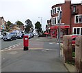
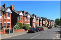
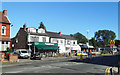
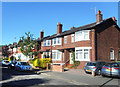

74 photos from this area
Area Information
Key information about the M21 8TJ including its size, population, and administrative classification.
- Area Type
- Postcode
- Area Size
- 1.0 hectares
- Population
- 1427
- Population Density
- 9364 people/km²
House Prices in M21 8TJ
59
Properties
£476,430
Average Sold Price
£93,000
Lowest Price
£992,500
Highest Price
Showing 59 properties
| Address | Type | Beds | Baths | Last Sale Price | Last Sale Date | |
|---|---|---|---|---|---|---|
| 39 Zetland Road, Manchester, M21 8TJ | house | - | - | £850,000 | Dec 2025 | |
| 41 Zetland Road, Manchester, M21 8TJ | Semi-detached | 6 | 1 | £992,500 | Aug 2025 | |
| 27 Zetland Road, Manchester, M21 8TJ | house | - | - | £852,000 | Dec 2020 | |
| 25 Zetland Road, Manchester, M21 8TJ | house | - | - | £645,000 | Oct 2019 | |
| 17 Zetland Road, Manchester, M21 8TJ | house | - | - | £570,000 | Dec 2014 | |
| 19 Zetland Road, Manchester, M21 8TJ | house | 5 | - | £360,000 | Jun 2012 | |
| 15 Zetland Road, Manchester, M21 8TJ | house | - | - | £445,000 | Jul 2010 | |
| 31 Zetland Road, Manchester, M21 8TJ | Semi-detached | - | - | £335,000 | Oct 2009 | |
| 29 Zetland Road, Manchester, M21 8TJ | Semi-detached | - | - | £439,000 | Jun 2008 | |
| 49 Zetland Road, Manchester, M21 8TJ | house | - | - | £382,000 | Apr 2007 |
Page 1 of 6
Energy Efficiency in M21 8TJ
Amenities
Schools
| Rank | School | Type | Entry gender | Ages |
|---|
Explore more schools in this area
Go to Schools tabDemographics
Household Size
One person
most common
Accommodation Type
Houses
most common
Tenure
48
majority
Ethnic Group
White
most common
Religion
N/A
most common
Household Composition
N/A
most common
Age
47
median
Adults (30-64 years)
most common
Household Deprivation
N/A
with no deprivation
NS-SEC
58
in Lower managerial occupations
Explore more demographic insights in this area
Go to Demographics tabPlanning
Planning Constraints
- Flood RiskPremium
- Ramsar Wetland SitesPremium
- Area of Outstanding Natural BeautyPremium
- Protected Nature ReservePremium
- Protected WoodlandPremium