Area Overview for M21 8FB
Photos of M21 8FB
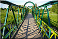
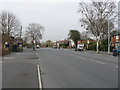
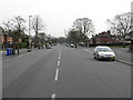
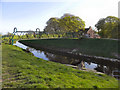
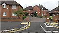
57 photos from this area
Area Information
Key information about the M21 8FB including its size, population, and administrative classification.
- Area Type
- Postcode
- Area Size
- 5458 m²
- Population
- 1529
- Population Density
- 280120 people/km²
House Prices in M21 8FB
13
Properties
£525,198
Average Sold Price
£105,000
Lowest Price
£867,500
Highest Price
Showing 13 properties
| Address | Type | Beds | Baths | Last Sale Price | Last Sale Date | |
|---|---|---|---|---|---|---|
| 58 South Drive, Manchester, M21 8FB | house | - | - | £775,000 | Sep 2021 | |
| 68 South Drive, Manchester, M21 8FB | house | - | - | £867,500 | Aug 2021 | |
| 74 South Drive, Manchester, M21 8FB | house | - | - | £867,000 | Mar 2021 | |
| 72 South Drive, Manchester, M21 8FB | house | - | - | £615,000 | May 2013 | |
| 70 South Drive, Manchester, M21 8FB | house | - | - | £462,482 | Jan 2013 | |
| 54 South Drive, Manchester, M21 8FB | house | - | - | £475,000 | Oct 2012 | |
| 60 South Drive, Manchester, M21 8FB | house | - | - | £375,000 | Apr 2007 | |
| 62 South Drive, Manchester, M21 8FB | Semi-detached | - | - | £360,000 | Nov 2005 | |
| 56 South Drive, Manchester, M21 8FB | house | - | - | £350,000 | Nov 2003 | |
| 50 South Drive, Manchester, M21 8FB | Semi-detached | - | - | £105,000 | May 1996 |
Page 1 of 2
Energy Efficiency in M21 8FB
Amenities
Schools
| Rank | School | Type | Entry gender | Ages |
|---|
Explore more schools in this area
Go to Schools tabDemographics
Household Size
Family (3-5 people)
most common
Accommodation Type
Houses
most common
Tenure
87
majority
Ethnic Group
White
most common
Religion
N/A
most common
Household Composition
N/A
most common
Age
47
median
Adults (30-64 years)
most common
Household Deprivation
N/A
with no deprivation
NS-SEC
64
in Lower managerial occupations
Explore more demographic insights in this area
Go to Demographics tabPlanning
Planning Constraints
- Flood RiskPremium
- Ramsar Wetland SitesPremium
- Area of Outstanding Natural BeautyPremium
- Protected Nature ReservePremium
- Protected WoodlandPremium