Area Overview for M21 7RA
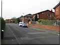
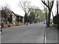
Photos of M21 7RA


Area Information
M21 7RA is a small, densely populated postcode area in England, covering just 1.4 hectares and home to 2,199 residents. Its compact size means it is a tightly knit residential cluster, where proximity to amenities and services is a defining feature. The area’s high population density—161,313 people per square kilometre—suggests a focus on housing rather than sprawling development. Daily life here is likely characterised by a mix of local shops, transport links, and community interactions. While the area’s size limits expansion, it offers a concentrated network of resources, including schools, retail, and public transport. Its location appears to be strategically placed near major infrastructure, such as rail and metro stations, which could enhance connectivity for residents. However, the area’s small footprint also means that any changes to local planning or development would have a significant impact on its existing character. For those considering living in M21 7RA, the balance between density and accessibility is key to understanding its appeal.
- Area Type
- Postcode
- Area Size
- 1.4 hectares
- Population
- 2199
- Population Density
- 3507 people/km²
In M21 7RA, 41% of residents are homeowners, while the remaining 59% are likely to be in rental accommodation. The area is predominantly composed of houses, which suggests a mix of single-family homes and possibly semi-detached properties. This contrasts with areas dominated by flats or apartments, and may indicate a preference for private, standalone living spaces. Given the small size of the postcode area, the housing stock is likely limited, with limited scope for new developments. For buyers, this means competition for available properties could be fierce, particularly for homes that meet the needs of the area’s primary demographic—middle-aged adults. The owner-occupation rate also suggests that properties here may be held for the long term, potentially offering stability for those seeking a place to settle. However, the lack of data on property prices or trends means buyers should consider the area’s limited size when assessing its broader housing market.
House Prices in M21 7RA
Showing 20 properties
| Address | Type | Beds | Baths | Last Sale Price | Last Sale Date | |
|---|---|---|---|---|---|---|
| 412 Mauldeth Road West, Manchester, M21 7RA | Semi-detached | 3 | 2 | £440,000 | May 2023 | |
| 408 Mauldeth Road West, Manchester, M21 7RA | house | - | - | £391,000 | May 2022 | |
| 422 Mauldeth Road West, Manchester, M21 7RA | Semi-detached | 3 | 1 | £285,000 | Aug 2020 | |
| 402 Mauldeth Road West, Manchester, M21 7RA | house | - | - | £265,000 | Dec 2016 | |
| 434 Mauldeth Road West, Manchester, M21 7RA | Semi-detached | 3 | - | £248,000 | Jun 2016 | |
| 424 Mauldeth Road West, Manchester, M21 7RA | house | - | - | £240,000 | Jan 2016 | |
| 428 Mauldeth Road West, Manchester, M21 7RA | house | 3 | - | £238,000 | Feb 2014 | |
| 426 Mauldeth Road West, Manchester, M21 7RA | house | - | - | £250,000 | Oct 2012 | |
| 410 Mauldeth Road West, Manchester, M21 7RA | house | - | - | £270,000 | Oct 2009 | |
| 406 Mauldeth Road West, Manchester, M21 7RA | Semi-detached | - | - | £204,950 | Jul 2005 |
Energy Efficiency in M21 7RA
Life in M21 7RA is supported by a range of amenities within practical reach. Retail options include major chains like Tesco Chorlton and Co-op Hardy, as well as M&S Chorlton-Cum, providing access to groceries, clothing, and household goods. The area’s proximity to metro stations such as St Werburgh’s Road and Barlow Moor Road, along with rail services at Burnage and Manchester United FC stations, ensures easy access to urban centres. For leisure, the nearby airports—Terminal One, Two, and Three—may offer travel opportunities or events. While the data does not specify parks or recreational spaces, the presence of multiple transport links and retail hubs suggests a lifestyle focused on convenience and connectivity. The compact nature of the area means that residents can likely reach most services on foot or by short public transport journeys, enhancing the area’s appeal for those prioritising accessibility.
Amenities
Schools
The nearest school to M21 7RA is CHS South, an academy with a good Ofsted rating. This suggests a reasonably performing institution that meets national standards for education. As an academy, it operates independently of local authority control, which may offer greater autonomy in curriculum and management. The presence of a single school within practical reach implies that families in M21 7RA have access to a dedicated educational facility, though no other schools are listed in the data. For parents, the good rating indicates that the school is likely to provide a reliable and effective education, though further details on specific subjects, student outcomes, or extracurricular offerings are not available. The proximity of CHS South may be a key consideration for families prioritising quality schooling in the area.
| Rank | School | Type | Entry gender | Ages |
|---|
Explore more schools in this area
Go to Schools tabDemographics
The population of M21 7RA skews heavily towards adults aged 30–64, with a median age of 47. This suggests a community of established professionals and families, rather than a younger or retired demographic. Home ownership stands at 41%, indicating that nearly half of residents are homeowners, while the remaining 59% may be renters or in other housing arrangements. The predominant accommodation type is houses, which aligns with the area’s compact size and likely suburban or semi-rural character. The predominant ethnic group is White, though no specific data on diversity or deprivation is provided. The age profile implies a stable, long-term resident base, with potential implications for local services and schools. For buyers, this demographic profile may suggest a mature, low-turnover market, where properties are likely to remain in the same hands for extended periods.
Household Size
Accommodation Type
Tenure
Ethnic Group
Religion
Household Composition
Age
Household Deprivation
NS-SEC
Explore more demographic insights in this area
Go to Demographics tabPlanning
Planning Constraints
- Flood RiskPremium
- Ramsar Wetland SitesPremium
- Area of Outstanding Natural BeautyPremium
- Protected Nature ReservePremium
- Protected WoodlandPremium