Area Overview for M21 7QT
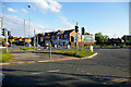
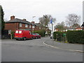
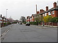
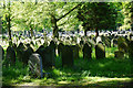
Photos of M21 7QT


Area Information
Living in M21 7QT means inhabiting a tightly packed residential cluster in England, where 2009 people reside across just 4902 square metres. The area’s population density of 409,825 people per square kilometre reflects its compact nature, creating a densely populated yet small-scale community. Daily life here is shaped by proximity to amenities, with retail, transport, and schools within practical reach. The area’s character is defined by its mature demographic, with a median age of 47 and most residents falling between 30 and 64. This suggests a community of established professionals and families, likely drawn to the area’s accessibility to Manchester’s infrastructure. While the postcode is small, its connectivity to rail, metro, and airports makes it a convenient base for commuters. The presence of schools and retail hubs nearby adds to its appeal for those prioritising convenience over expansive space.
- Area Type
- Postcode
- Area Size
- 4902 m²
- Population
- 2009
- Population Density
- 2310 people/km²
The property market in M21 7QT is characterised by a 53% home ownership rate, with houses forming the primary accommodation type. This indicates a mix of owner-occupied homes and rental properties, though the small area size suggests limited housing stock. The dominance of houses over flats or apartments may appeal to families or those seeking more space, but the compact nature of the postcode means opportunities for new builds or larger properties are constrained. Buyers should consider that the area’s high population density—409,825 people per square kilometre—could influence property values, with demand potentially outpacing supply. For those seeking a home, the focus is likely on existing houses, though the small size of the area may limit options for buyers looking to expand their search beyond immediate surroundings.
House Prices in M21 7QT
Showing 8 properties
| Address | Type | Beds | Baths | Last Sale Price | Last Sale Date | |
|---|---|---|---|---|---|---|
| 8 Derwent Close, Manchester, M21 7QT | house | 3 | 1 | £193,400 | Oct 2014 | |
| 2 Derwent Close, Manchester, M21 7QT | Semi-detached | 3 | 1 | £175,000 | Dec 2013 | |
| 6 Derwent Close, Manchester, M21 7QT | house | 3 | - | £175,000 | Sep 2008 | |
| 10 Derwent Close, Manchester, M21 7QT | Terraced | 3 | 1 | £105,000 | Sep 2002 | |
| 14 Derwent Close, Manchester, M21 7QT | Semi-detached | - | - | £38,250 | Apr 1997 | |
| 4 Derwent Close, Manchester, M21 7QT | Terraced | 3 | 1 | £43,500 | Dec 1996 | |
| 16 Derwent Close, Manchester, M21 7QT | Semi-detached | - | - | - | - | |
| 12 Derwent Close, Manchester, M21 7QT | house | - | - | - | - |
Energy Efficiency in M21 7QT
Residents of M21 7QT benefit from a range of amenities within walking or short-vehicle distance. Five retail outlets, including Asda West and Co-op Hardy, provide essential shopping options. Metro stops such as Barlow Moor Road and Withington, along with rail stations like Burnage and East Didsbury, ensure easy access to Manchester’s commercial and cultural hubs. The area’s proximity to four airport terminals, including Terminal Two Access, makes it convenient for frequent travelers. While the data does not specify parks or leisure facilities, the density of retail and transport options suggests a lifestyle focused on convenience and connectivity. The mix of retail, transport, and airport access creates a practical environment for those prioritising ease of movement over expansive green spaces.
Amenities
Schools
Residents of M21 7QT have access to three schools within practical reach. Barlow Hall Junior School and Barlow Hall Infant School are both primary institutions, providing early education for children aged 4–11. The Manchester Secondary PRU, however, is categorised as “other,” likely indicating a special needs or alternative education provision. This mix of school types suggests a range of educational options, though the absence of secondary schools in the immediate vicinity may require families to travel for older children. The presence of primary schools is a clear advantage for parents, but the lack of detailed Ofsted ratings means the quality of education cannot be assessed. Families should investigate further to understand the full range of opportunities available to students in the area.
| Rank | School | Type | Entry gender | Ages |
|---|
Explore more schools in this area
Go to Schools tabDemographics
The population of M21 7QT is predominantly adults aged 30–64, with a median age of 47. This suggests a community of middle-aged residents, many of whom may be in their peak earning years or raising families. Home ownership stands at 53%, indicating a slight majority of owner-occupied properties, though nearly half of residents are likely renters. The accommodation type is primarily houses, which, in a small area, implies a mix of family homes and smaller residences. The predominant ethnic group is White, with no data provided on other demographics. The high population density—409,825 people per square kilometre—means residents live closely together, which can foster a tight-knit community but may also challenge privacy. The age profile and home ownership rate suggest a stable, long-term resident base, though the lack of diversity data limits a fuller understanding of the area’s social fabric.
Household Size
Accommodation Type
Tenure
Ethnic Group
Religion
Household Composition
Age
Household Deprivation
NS-SEC
Explore more demographic insights in this area
Go to Demographics tabPlanning
Planning Constraints
- Flood RiskPremium
- Ramsar Wetland SitesPremium
- Area of Outstanding Natural BeautyPremium
- Protected Nature ReservePremium
- Protected WoodlandPremium