Area Overview for M21 7QQ
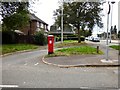
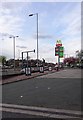
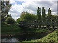
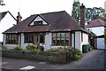
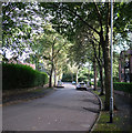
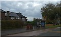
Photos of M21 7QQ

Area Information
Living in M21 7QQ means inhabiting a tightly packed residential cluster in England, where 1,643 people reside across just 1.1 hectares. The area’s high population density of 154,642 people per square kilometre reflects its compact nature, shaped by a mix of single-family homes. This postcode is defined by its proximity to urban infrastructure, with nearby rail stations, bus routes, and retail hubs within practical reach. The community here skews older, with a median age of 47, and most residents are adults aged 30–64. Daily life is influenced by the area’s connectivity to major transport routes and its position near Manchester’s broader network. While the housing stock is dominated by owner-occupied properties, the small size of the area means buyers must consider the immediate surroundings for larger amenities. The area’s character is defined by its balance of residential tranquillity and accessibility to urban services, though its density may feel restrictive for those seeking more space.
- Area Type
- Postcode
- Area Size
- 1.1 hectares
- Population
- 1643
- Population Density
- 3745 people/km²
The property market in M21 7QQ is characterised by a strong presence of owner-occupied homes, with 65% of properties owned by residents rather than rented. The accommodation type is predominantly houses, which is unusual for a small, densely populated area. This suggests a mix of semi-detached and terraced housing, likely built for families or long-term residents. Given the area’s limited size, the housing stock is finite, meaning buyers must consider nearby zones for additional options. The high home ownership rate indicates a stable market with fewer rental properties, which may appeal to those seeking investment in a settled community. However, the compact nature of M21 7QQ means property values are likely influenced by proximity to transport links and amenities, rather than the size of the homes themselves. Buyers should also note that the area’s small footprint may limit future development potential.
House Prices in M21 7QQ
Showing 24 properties
| Address | Type | Beds | Baths | Last Sale Price | Last Sale Date | |
|---|---|---|---|---|---|---|
| 17 Macefin Avenue, Manchester, M21 7QQ | Semi-detached | 4 | 1 | £550,000 | May 2022 | |
| 16 Macefin Avenue, Manchester, M21 7QQ | Semi-detached | 3 | 1 | £550,000 | May 2020 | |
| 14 Macefin Avenue, Manchester, M21 7QQ | Semi-detached | 4 | 1 | £415,000 | Mar 2020 | |
| 18 Macefin Avenue, Manchester, M21 7QQ | house | - | - | £520,000 | Nov 2019 | |
| 12 Macefin Avenue, Manchester, M21 7QQ | Semi-detached | 3 | 1 | £320,000 | Aug 2015 | |
| 19 Macefin Avenue, Manchester, M21 7QQ | Semi-detached | 4 | - | £369,950 | Oct 2014 | |
| 4 Macefin Avenue, Manchester, M21 7QQ | Semi-detached | 4 | 1 | £345,000 | Dec 2013 | |
| 20 Macefin Avenue, Manchester, M21 7QQ | house | - | - | £349,950 | Apr 2012 | |
| 23 Macefin Avenue, Manchester, M21 7QQ | house | - | - | £247,000 | Feb 2011 | |
| 15 Macefin Avenue, Manchester, M21 7QQ | Semi-detached | - | - | £360,000 | Jul 2008 |
Energy Efficiency in M21 7QQ
The lifestyle in M21 7QQ is shaped by its proximity to essential amenities. Retail options include Asda West, Co-op West, and Co-op Hardy, offering everyday shopping needs. Metro stops like Barlow Moor Road and Burton Road provide access to public transport, while rail stations such as Burnage and Mauldeth Road connect residents to Manchester’s broader network. The area’s nearness to multiple airports, including Terminal Two Access, adds convenience for those working in aviation or requiring frequent travel. Though the data does not specify parks or leisure facilities, the presence of multiple transport hubs and retail outlets suggests a focus on practicality over green spaces. The compact layout means residents must venture slightly beyond the postcode for larger recreational areas, but the immediate surroundings offer sufficient infrastructure for daily living.
Amenities
Schools
Residents of M21 7QQ have access to two distinct educational institutions. St Ambrose RC Primary School, a state-funded primary school with an Ofsted rating of ‘good’, serves the local community with a focus on Catholic education. Nearby, the South Manchester Jewish Preparatory School offers an independent education, catering to a specific demographic. The presence of both a state and independent school provides families with choice, though the latter may be more exclusive and costly. For parents prioritising religious or cultural education, these options are significant. However, the data does not specify the catchment areas or student numbers, so prospective families should verify whether these schools meet their needs. The mix of school types reflects the area’s diverse but tightly defined community.
| Rank | School | Type | Entry gender | Ages |
|---|
Explore more schools in this area
Go to Schools tabDemographics
The population of M21 7QQ is predominantly adults aged 30–64, with a median age of 47. This suggests a mature, stable community, likely with established careers and families. Home ownership is high at 65%, indicating a preference for long-term residency over rental properties. The accommodation type is primarily houses, which aligns with the area’s compact footprint and suggests a mix of semi-detached and terraced homes. The predominant ethnic group is White, reflecting broader demographic trends in the region. While no specific data on deprivation is provided, the high home ownership rate and age profile imply a relatively stable economic base. However, the absence of detailed diversity metrics means the community’s full composition remains less defined. The area’s small size and focus on owner-occupied housing suggest a cohesive, possibly insular social fabric, with limited turnover of residents.
Household Size
Accommodation Type
Tenure
Ethnic Group
Religion
Household Composition
Age
Household Deprivation
NS-SEC
Explore more demographic insights in this area
Go to Demographics tabPlanning
Planning Constraints
- Flood RiskPremium
- Ramsar Wetland SitesPremium
- Area of Outstanding Natural BeautyPremium
- Protected Nature ReservePremium
- Protected WoodlandPremium