Area Overview for M21 7PP
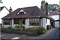
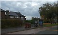
Photos of M21 7PP


Area Information
M21 7PP is a small, densely populated residential cluster in England, spanning just 5,271 square metres and home to 1,677 people. Its compact size creates a tight-knit community, though the population density of 318,182 people per square kilometre reflects its limited space. The area is dominated by houses, with a median age of 47 and the majority of residents aged between 30 and 64. This suggests a mature, stable population, likely centred around middle-aged professionals and families. Daily life here is shaped by proximity to amenities, with multiple retail outlets, transport links, and nearby airports within practical reach. The area’s small footprint means it is not sprawling, but its density can create a sense of closeness. For those seeking a quiet, focused living environment with access to urban conveniences, M21 7PP offers a balance of residential comfort and connectivity, albeit within a tightly defined space.
- Area Type
- Postcode
- Area Size
- 5271 m²
- Population
- 1677
- Population Density
- 3934 people/km²
The property market in M21 7PP is characterised by a low home ownership rate of 32%, indicating that the majority of residents are likely renting rather than owning their homes. The accommodation type is primarily houses, which may suggest a focus on family-sized properties, though the small area size and high population density imply limited housing stock. This combination of low ownership and house-based housing could make the area more competitive for buyers, as the number of owner-occupied properties is relatively small. For those seeking a home, the compact nature of M21 7PP means the immediate surroundings are key, with limited scope for expansion. Buyers should consider the rental market’s dominance and the potential for competition among buyers in a constrained environment.
House Prices in M21 7PP
Showing 18 properties
| Address | Type | Beds | Baths | Last Sale Price | Last Sale Date | |
|---|---|---|---|---|---|---|
| 8 Brandwood Avenue, Manchester, M21 7PP | house | 3 | - | £231,500 | Feb 2022 | |
| 4 Brandwood Avenue, Manchester, M21 7PP | Semi-detached | 3 | 2 | £202,000 | Jun 2020 | |
| 18 Brandwood Avenue, Manchester, M21 7PP | house | - | - | £39,000 | Jun 2000 | |
| 16 Brandwood Avenue, Manchester, M21 7PP | house | - | - | - | - | |
| 34 Brandwood Avenue, Manchester, M21 7PP | house | - | - | - | - | |
| 28 Brandwood Avenue, Manchester, M21 7PP | house | - | - | - | - | |
| 36 Brandwood Avenue, Manchester, M21 7PP | house | - | - | - | - | |
| 20 Brandwood Avenue, Manchester, M21 7PP | house | - | - | - | - | |
| 26 Brandwood Avenue, Manchester, M21 7PP | house | - | - | - | - | |
| 24 Brandwood Avenue, Manchester, M21 7PP | Semi-detached | - | - | - | - |
Energy Efficiency in M21 7PP
Living in M21 7PP offers access to a range of amenities within practical reach. Retail options include Asda West, Co-op Palatine, and Co-op Hardy, providing everyday shopping convenience. The area is served by five metro stops, including Barlow Moor Road and Burton Road, and five rail stations such as East Didsbury and Burnage, ensuring frequent public transport connections. Nearby airports, including Terminal Two and Terminal Three Access, make air travel accessible. A single bus stop at Chorlton Street Coach Station complements the transport network. While the area is small, its proximity to multiple transport hubs and retail outlets suggests a lifestyle that balances convenience with urban connectivity. The availability of shops, transport, and airports supports a practical, efficient daily routine for residents.
Amenities
Schools
| Rank | School | Type | Entry gender | Ages |
|---|
Explore more schools in this area
Go to Schools tabDemographics
The community in M21 7PP is predominantly composed of adults aged 30 to 64, with a median age of 47. This indicates a population skewed towards middle-aged individuals, likely including professionals and families. Home ownership is relatively low at 32%, suggesting that a majority of residents rent their homes. The accommodation type is primarily houses, which may reflect a preference for family-sized properties. The predominant ethnic group is White, though no specific data on diversity or deprivation is provided. The high proportion of adults in the 30–64 age range suggests a community with established careers and possibly children in school. This demographic profile points to a stable, mature population, though the low home ownership rate may indicate a reliance on rental housing or a transient element within the area.
Household Size
Accommodation Type
Tenure
Ethnic Group
Religion
Household Composition
Age
Household Deprivation
NS-SEC
Explore more demographic insights in this area
Go to Demographics tabPlanning
Planning Constraints
- Flood RiskPremium
- Ramsar Wetland SitesPremium
- Area of Outstanding Natural BeautyPremium
- Protected Nature ReservePremium
- Protected WoodlandPremium