Area Overview for M21 7GF
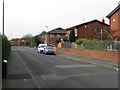
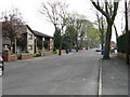
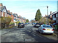
Photos of M21 7GF


Area Information
Living in M21 7GF means inhabiting a compact residential cluster in England, where 1,822 people reside across 5,932 square metres. This densely populated area, with 307,161 people per square kilometre, reflects a tight-knit community. The median age of 47 suggests a mature demographic, with adults aged 30–64 forming the largest group. While the area’s small size limits expansion, its proximity to multiple transport hubs and amenities offers convenience. Residents benefit from excellent broadband connectivity, rated 100 out of 100, ensuring seamless digital access. However, the area’s high crime risk—classified as critical—requires caution. Despite this, M21 7GF’s mix of retail, rail, and metro options creates a practical urban environment. The lack of protected natural sites or flood risks means safety concerns are limited to crime. For those prioritising connectivity and accessibility, this postcode provides a compact, functional base.
- Area Type
- Postcode
- Area Size
- 5932 m²
- Population
- 1822
- Population Density
- 4345 people/km²
M21 7GF’s property market is characterised by a low home ownership rate of 31%, suggesting most residents rent rather than own. The accommodation type is predominantly houses, which is atypical for a densely populated area of this size. This combination implies a limited supply of owner-occupied homes, potentially making the area more attractive to renters. The small size of the postcode—just 5,932 square metres—means housing stock is constrained, with little scope for expansion. Buyers seeking owner-occupied properties may find fewer options here, necessitating a broader search in nearby areas. The market’s rental focus could benefit those prioritising flexibility, but it may also mean competition for available homes. The lack of protected land or planning constraints allows for development, though the high population density may already limit availability.
House Prices in M21 7GF
Showing 36 properties
| Address | Type | Beds | Baths | Last Sale Price | Last Sale Date | |
|---|---|---|---|---|---|---|
| 16 Wishaw Square, Manchester, M21 7GF | Flat | - | - | £160,000 | Oct 2025 | |
| 22 Wishaw Square, Manchester, M21 7GF | Flat | - | - | - | - | |
| 20 Wishaw Square, Manchester, M21 7GF | Flat | - | - | - | - | |
| 39 Wishaw Square, Manchester, M21 7GF | Flat | - | - | - | - | |
| 26 Wishaw Square, Manchester, M21 7GF | Flat | - | - | - | - | |
| 43 Wishaw Square, Manchester, M21 7GF | house | - | - | - | - | |
| 23 Wishaw Square, Manchester, M21 7GF | Flat | - | - | - | - | |
| 35 Wishaw Square, Manchester, M21 7GF | house | - | - | - | - | |
| 41 Wishaw Square, Manchester, M21 7GF | Flat | - | - | - | - | |
| 21 Wishaw Square, Manchester, M21 7GF | Maisonette | - | - | - | - |
Energy Efficiency in M21 7GF
Residents of M21 7GF have access to a range of amenities within practical reach. Retail options include Co-op Hardy, Tesco Chorlton, and M&S Chorlton-Cum, offering everyday shopping needs. The metro stations—Withington, St Werburgh’s Road, and Barlow Moor Road—provide easy access to urban hubs, while rail stations like Burnage and East Didsbury connect to broader networks. A single bus stop at Chorlton Street Coach Station adds to transport flexibility. The proximity to three airports—Terminal One, Two, and Three—caters to frequent travellers. While the area lacks parks or leisure facilities in the data, its density and connectivity suggest a focus on urban convenience. The mix of retail, transport, and travel options creates a lifestyle suited to those prioritising accessibility over expansive green spaces.
Amenities
Schools
The nearest school to M21 7GF is Loreto High School Chorlton, a primary school with a satisfactory Ofsted rating. This single school option means families must rely on this institution for primary education. The absence of secondary schools in the data suggests parents may need to consider nearby areas for secondary schooling. Loreto’s satisfactory rating indicates it meets basic standards but may not offer exceptional resources. For families prioritising proximity to schools, this postcode provides a primary option, though secondary education would require additional travel. The limited school choice reflects the area’s small size and may influence decisions for households with children requiring a broader range of educational facilities.
| Rank | School | Type | Entry gender | Ages |
|---|
Explore more schools in this area
Go to Schools tabDemographics
The population of M21 7GF is predominantly adults aged 30–64, with a median age of 47. Only 31% of residents own their homes, indicating a rental-heavy market. The accommodation type is primarily houses, which is unusual for such a high-density area. The predominant ethnic group is White, with no specific data on other demographics. The low home ownership rate suggests a transient population, potentially influenced by the area’s limited housing stock. With 1,822 residents in 5,932 square metres, the population density is exceptionally high—307,161 people per square kilometre. This density may impact community dynamics, though the absence of detailed deprivation data means quality of life factors like public services or social cohesion remain unquantified. The demographic profile paints a picture of a mature, possibly middle-class population with limited long-term residency.
Household Size
Accommodation Type
Tenure
Ethnic Group
Religion
Household Composition
Age
Household Deprivation
NS-SEC
Explore more demographic insights in this area
Go to Demographics tabPlanning
Planning Constraints
- Flood RiskPremium
- Ramsar Wetland SitesPremium
- Area of Outstanding Natural BeautyPremium
- Protected Nature ReservePremium
- Protected WoodlandPremium