Area Overview for M21 0UT
Photos of M21 0UT
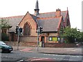
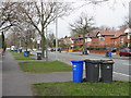
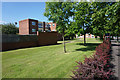
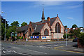
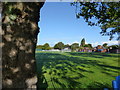

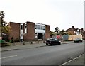
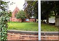
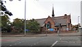


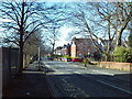
24 photos from this area
Area Information
Key information about the M21 0UT including its size, population, and administrative classification.
- Area Type
- Postcode
- Area Size
- 2.3 hectares
- Population
- 1547
- Population Density
- 5652 people/km²
House Prices in M21 0UT
23
Properties
£313,000
Average Sold Price
£81,000
Lowest Price
£725,000
Highest Price
Showing 23 properties
| Address | Type | Beds | Baths | Last Sale Price | Last Sale Date | |
|---|---|---|---|---|---|---|
| 423 Wilbraham Road, Manchester, M21 0UT | Semi-detached | 3 | 1 | £528,000 | Feb 2025 | |
| 401 Wilbraham Road, Manchester, M21 0UT | Detached | 3 | 1 | £725,000 | Jul 2024 | |
| 403 Wilbraham Road, Manchester, M21 0UT | house | - | - | £155,995 | Nov 2022 | |
| 421 Wilbraham Road, Manchester, M21 0UT | Detached | 3 | 2 | £580,000 | Oct 2022 | |
| 409 Wilbraham Road, Manchester, M21 0UT | Detached | 5 | 3 | £655,000 | Sep 2020 | |
| 385 Wilbraham Road, Manchester, M21 0UT | Detached | 6 | 5 | £665,000 | Mar 2016 | |
| 425 Wilbraham Road, Manchester, M21 0UT | house | - | - | £370,000 | Nov 2015 | |
| 393 Wilbraham Road, Manchester, M21 0UT | Detached | 4 | 2 | £445,000 | Oct 2015 | |
| 395 Wilbraham Road, Manchester, M21 0UT | house | - | - | £125,000 | Dec 2012 | |
| 397 Wilbraham Road, Manchester, M21 0UT | Detached | - | - | £337,500 | Aug 2005 |
Page 1 of 3
Energy Efficiency in M21 0UT
Amenities
Schools
| Rank | School | Type | Entry gender | Ages |
|---|
Explore more schools in this area
Go to Schools tabDemographics
Household Size
Family (3-5 people)
most common
Accommodation Type
Houses
most common
Tenure
81
majority
Ethnic Group
asian_total
most common
Religion
N/A
most common
Household Composition
N/A
most common
Age
47
median
Adults (30-64 years)
most common
Household Deprivation
N/A
with no deprivation
NS-SEC
38
in Lower managerial occupations
Explore more demographic insights in this area
Go to Demographics tabPlanning
Planning Constraints
- Flood RiskPremium
- Ramsar Wetland SitesPremium
- Area of Outstanding Natural BeautyPremium
- Protected Nature ReservePremium
- Protected WoodlandPremium