Area Overview for M21 0RE
Photos of M21 0RE
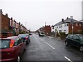
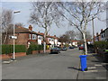
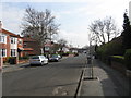

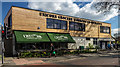
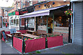
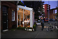
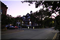
70 photos from this area
Area Information
Key information about the M21 0RE including its size, population, and administrative classification.
- Area Type
- Postcode
- Area Size
- 3563 m²
- Population
- 1579
- Population Density
- 6702 people/km²
House Prices in M21 0RE
10
Properties
£174,667
Average Sold Price
£38,500
Lowest Price
£452,500
Highest Price
Showing 10 properties
| Address | Type | Beds | Baths | Last Sale Price | Last Sale Date | |
|---|---|---|---|---|---|---|
| 259 Manley Road, Manchester, M21 0RE | Semi-detached | 3 | 1 | £452,500 | Mar 2025 | |
| 257 Manley Road, Manchester, M21 0RE | Semi-detached | 3 | 1 | £230,000 | May 2007 | |
| 249 Manley Road, Manchester, M21 0RE | Semi-detached | - | - | £200,000 | Dec 2005 | |
| 261 Manley Road, Manchester, M21 0RE | Semi-detached | - | - | £82,000 | May 2001 | |
| 251 Manley Road, Manchester, M21 0RE | house | - | - | £45,000 | Oct 1998 | |
| 245 Manley Road, Manchester, M21 0RE | Semi-detached | 3 | 1 | £38,500 | Mar 1998 | |
| 247 Manley Road, Manchester, M21 0RE | Terraced | - | - | - | - | |
| 263 Manley Road, Manchester, M21 0RE | house | - | - | - | - | |
| 255 Manley Road, Manchester, M21 0RE | Semi-detached | - | - | - | - | |
| 253 Manley Road, Manchester, M21 0RE | house | - | - | - | - |
Energy Efficiency in M21 0RE
Amenities
Schools
| Rank | School | Type | Entry gender | Ages |
|---|
Explore more schools in this area
Go to Schools tabDemographics
Household Size
Family (3-5 people)
most common
Accommodation Type
Houses
most common
Tenure
77
majority
Ethnic Group
asian_total
most common
Religion
N/A
most common
Household Composition
N/A
most common
Age
47
median
Adults (30-64 years)
most common
Household Deprivation
N/A
with no deprivation
NS-SEC
38
in Lower managerial occupations
Explore more demographic insights in this area
Go to Demographics tabPlanning
Planning Constraints
- Flood RiskPremium
- Ramsar Wetland SitesPremium
- Area of Outstanding Natural BeautyPremium
- Protected Nature ReservePremium
- Protected WoodlandPremium