Area Overview for M21 0QT
Photos of M21 0QT
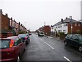
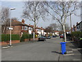
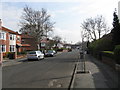
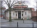


70 photos from this area
Area Information
Key information about the M21 0QT including its size, population, and administrative classification.
- Area Type
- Postcode
- Area Size
- 9282 m²
- Population
- 1567
- Population Density
- 6980 people/km²
House Prices in M21 0QT
17
Properties
£290,531
Average Sold Price
£62,000
Lowest Price
£470,000
Highest Price
Showing 17 properties
| Address | Type | Beds | Baths | Last Sale Price | Last Sale Date | |
|---|---|---|---|---|---|---|
| 79 Buckingham Road, Manchester, M21 0QT | house | 3 | 1 | £452,500 | Nov 2023 | |
| 83 Buckingham Road, Manchester, M21 0QT | house | - | - | £450,000 | Dec 2021 | |
| 73 Buckingham Road, Manchester, M21 0QT | house | - | - | £470,000 | Jan 2021 | |
| 63 Buckingham Road, Manchester, M21 0QT | Semi-detached | 3 | 1 | £430,000 | Jan 2019 | |
| 87 Buckingham Road, Manchester, M21 0QT | Semi-detached | 3 | 1 | £288,000 | Sep 2018 | |
| 91 Buckingham Road, Manchester, M21 0QT | house | - | - | £310,000 | May 2017 | |
| 61 Buckingham Road, Manchester, M21 0QT | house | 3 | 1 | £305,000 | Jan 2017 | |
| 81 Buckingham Road, Manchester, M21 0QT | house | - | - | £239,000 | May 2014 | |
| 71 Buckingham Road, Manchester, M21 0QT | Semi-detached | - | - | £247,500 | Jun 2012 | |
| 89 Buckingham Road, Manchester, M21 0QT | Terraced | - | - | £229,950 | Apr 2007 |
Page 1 of 2
Energy Efficiency in M21 0QT
Amenities
Schools
| Rank | School | Type | Entry gender | Ages |
|---|
Explore more schools in this area
Go to Schools tabDemographics
Household Size
Two person
most common
Accommodation Type
Houses
most common
Tenure
67
majority
Ethnic Group
White
most common
Religion
N/A
most common
Household Composition
N/A
most common
Age
47
median
Adults (30-64 years)
most common
Household Deprivation
N/A
with no deprivation
NS-SEC
45
in Lower managerial occupations
Explore more demographic insights in this area
Go to Demographics tabPlanning
Planning Constraints
- Flood RiskPremium
- Ramsar Wetland SitesPremium
- Area of Outstanding Natural BeautyPremium
- Protected Nature ReservePremium
- Protected WoodlandPremium