Area Overview for M20 5QS
Photos of M20 5QS
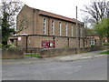
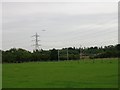
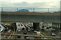
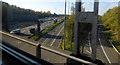

21 photos from this area
Area Information
Key information about the M20 5QS including its size, population, and administrative classification.
- Area Type
- Postcode
- Area Size
- 5202 m²
- Population
- 1520
- Population Density
- 2152 people/km²
House Prices in M20 5QS
15
Properties
£225,617
Average Sold Price
£65,200
Lowest Price
£360,000
Highest Price
Showing 15 properties
| Address | Type | Beds | Baths | Last Sale Price | Last Sale Date | |
|---|---|---|---|---|---|---|
| 591 Parrs Wood Road, Manchester, M20 5QS | Semi-detached | 3 | 1 | £339,000 | Dec 2023 | |
| 581 Parrs Wood Road, Manchester, M20 5QS | house | 3 | 1 | £360,000 | Aug 2022 | |
| 583 Parrs Wood Road, Manchester, M20 5QS | house | - | - | £250,000 | Feb 2017 | |
| 569 Parrs Wood Road, Manchester, M20 5QS | house | - | - | £170,000 | Jun 2011 | |
| 587 Parrs Wood Road, Manchester, M20 5QS | Semi-detached | - | - | £169,500 | Dec 2000 | |
| 579 Parrs Wood Road, Manchester, M20 5QS | house | - | - | £65,200 | Jul 1997 | |
| 571 Parrs Wood Road, Manchester, M20 5QS | Semi-detached | - | - | - | - | |
| 575 Parrs Wood Road, Manchester, M20 5QS | Semi-detached | - | - | - | - | |
| 565 Parrs Wood Road, Manchester, M20 5QS | Semi-detached | - | - | - | - | |
| 589 Parrs Wood Road, Manchester, M20 5QS | house | 3 | 1 | - | - |
Page 1 of 2
Energy Efficiency in M20 5QS
Amenities
Schools
| Rank | School | Type | Entry gender | Ages |
|---|
Explore more schools in this area
Go to Schools tabDemographics
Household Size
Family (3-5 people)
most common
Accommodation Type
Houses
most common
Tenure
78
majority
Ethnic Group
White
most common
Religion
N/A
most common
Household Composition
N/A
most common
Age
47
median
Adults (30-64 years)
most common
Household Deprivation
N/A
with no deprivation
NS-SEC
48
in Lower managerial occupations
Explore more demographic insights in this area
Go to Demographics tabPlanning
Planning Constraints
- Flood RiskPremium
- Ramsar Wetland SitesPremium
- Area of Outstanding Natural BeautyPremium
- Protected Nature ReservePremium
- Protected WoodlandPremium