Area Overview for M20 2LR
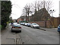
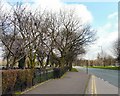
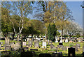
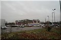
Photos of M20 2LR


Area Information
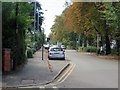
Living in M20 2LR means inhabiting a compact, densely populated residential cluster in England. The area covers just 3 hectares, yet it houses 1,838 residents, translating to a population density of 60,755 people per square kilometre. This high density reflects a community focused on urban living, with limited space for expansion. The area’s character is shaped by its proximity to amenities and transport links, making it practical for those prioritising accessibility over space. Flats dominate the housing stock, suggesting a mix of long-term residents and renters. While the area lacks natural landscapes or protected sites, its strategic location near retail, transport, and schools offers convenience. Daily life here is defined by proximity to services, though the compact size means residents must navigate shared spaces and community interactions closely. For those seeking a location with immediate access to urban infrastructure, M20 2LR provides a concentrated, if tightly packed, living environment.
- Area Type
- Postcode
- Area Size
- 3.0 hectares
- Population
- 1838
- Population Density
- 5037 people/km²
The property market in M20 2LR is characterised by a low rate of home ownership—just 36% of residents own their homes. This indicates a rental-dominated market, with flats forming the primary accommodation type. The small area size of 3 hectares and high population density suggest limited housing stock, which may drive competition among renters. For buyers, this presents a challenge: the area’s compact nature means there are few properties available, and those that exist are likely to be flats rather than larger homes. Prospective purchasers should consider the surrounding areas for more options, though proximity to amenities and transport links may offset the lack of space. The market is likely to cater to those prioritising convenience over property size, with limited scope for long-term investment in ownership.
House Prices in M20 2LR
No properties found in this postcode.
Energy Efficiency in M20 2LR
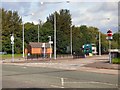
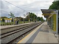
Daily life in M20 2LR is shaped by its proximity to a range of amenities. Residents have access to five retail outlets, including Co-op West and Asda West, offering convenience for grocery shopping. Metro stations like Burton Road and West Didsbury provide easy access to urban centres, while rail stations such as Burnage and East Didsbury connect to broader regional networks. The Chorlton Street Coach Station adds flexibility for local travel. For leisure, the area’s proximity to airports—Terminal One, Two, and Three Access—may appeal to those working in aviation or travel. While parks and green spaces are not explicitly listed, the compact layout suggests a focus on urban living rather than outdoor recreation. The density of amenities ensures that essentials are within walking distance, though larger recreational options may require a trip to nearby areas.
Amenities
Schools
Residents of M20 2LR have access to three special schools: Lancasterian School, The Birches School, and Newbrook School. All three are designated as special schools, catering to students with specific educational needs. This mix of school types suggests the area is well-suited for families requiring tailored support for children with learning differences or disabilities. While no Ofsted ratings are provided, the presence of multiple special schools indicates a focus on inclusive education. For families seeking such provisions, the proximity of these institutions is a key advantage. However, the absence of mainstream schools in the data means those prioritising traditional education may need to look further afield. The availability of special schools underscores the area’s practical orientation, catering to specific needs within the community.
| Rank | School | Type | Entry gender | Ages |
|---|
Explore more schools in this area
Go to Schools tabDemographics
The community in M20 2LR is predominantly composed of adults aged 30–64, with a median age of 47. This suggests a mature population, likely with established careers and family structures. Home ownership is relatively low at 36%, indicating that a majority of residents are renters. The accommodation type is largely flats, reflecting a housing stock suited to urban living rather than detached homes. The predominant ethnic group is White, though no specific data on diversity or minority representation is provided. The high population density, combined with the age profile, implies a stable, settled community with limited turnover. However, the lack of data on deprivation or income levels means the area’s economic profile remains unclear. For those considering relocation, the demographic mix suggests a focus on practicality over luxury, with a population that values accessibility over space.
Household Size
Accommodation Type
Tenure
Ethnic Group
Religion
Household Composition
Age
Household Deprivation
NS-SEC
Explore more demographic insights in this area
Go to Demographics tabPlanning
Planning Constraints
- Flood RiskPremium
- Ramsar Wetland SitesPremium
- Area of Outstanding Natural BeautyPremium
- Protected Nature ReservePremium
- Protected WoodlandPremium