Area Overview for M20 1AD
Photos of M20 1AD


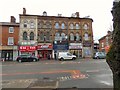
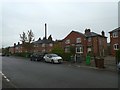


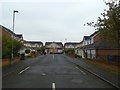

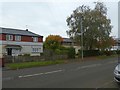


89 photos from this area
Area Information
Key information about the M20 1AD including its size, population, and administrative classification.
- Area Type
- Postcode
- Area Size
- 1.0 hectares
- Population
- 1854
- Population Density
- 7981 people/km²
House Prices in M20 1AD
29
Properties
£161,191
Average Sold Price
£15,960
Lowest Price
£360,000
Highest Price
Showing 29 properties
| Address | Type | Beds | Baths | Last Sale Price | Last Sale Date | |
|---|---|---|---|---|---|---|
| 156 Mauldeth Road West, Manchester, M20 1AD | Terraced | 3 | 1 | £235,000 | Feb 2024 | |
| 166 Mauldeth Road West, Manchester, M20 1AD | Semi-detached | 5 | 2 | £360,000 | Feb 2023 | |
| 168 Mauldeth Road West, Manchester, M20 1AD | house | - | - | £200,000 | Nov 2021 | |
| 150 Mauldeth Road West, Manchester, M20 1AD | house | - | - | £243,000 | Oct 2020 | |
| 158 Mauldeth Road West, Manchester, M20 1AD | house | - | - | £160,000 | Mar 2017 | |
| 136 Mauldeth Road West, Manchester, M20 1AD | Terraced | 3 | 1 | £156,500 | Jan 2017 | |
| 140 Mauldeth Road West, Manchester, M20 1AD | Semi-detached | - | - | £116,000 | Dec 2003 | |
| 122 Mauldeth Road West, Manchester, M20 1AD | Semi-detached | - | - | £69,950 | Jul 2002 | |
| 120 Mauldeth Road West, Manchester, M20 1AD | Semi-detached | - | - | £15,960 | May 2000 | |
| 132 Mauldeth Road West, Manchester, M20 1AD | Detached | 3 | 1 | £55,500 | Jan 2000 |
Page 1 of 3
Energy Efficiency in M20 1AD
Amenities
Schools
| Rank | School | Type | Entry gender | Ages |
|---|
Explore more schools in this area
Go to Schools tabDemographics
Household Size
Family (3-5 people)
most common
Accommodation Type
Houses
most common
Tenure
51
majority
Ethnic Group
White
most common
Religion
N/A
most common
Household Composition
N/A
most common
Age
22
median
Young Adults (15-29 years)
most common
Household Deprivation
N/A
with no deprivation
NS-SEC
21
in Lower managerial occupations
Explore more demographic insights in this area
Go to Demographics tabPlanning
Planning Constraints
- Flood RiskPremium
- Ramsar Wetland SitesPremium
- Area of Outstanding Natural BeautyPremium
- Protected Nature ReservePremium
- Protected WoodlandPremium