Area Overview for M19 3NQ
Photos of M19 3NQ
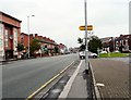
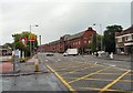


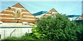
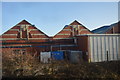
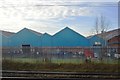
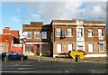

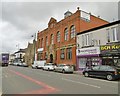

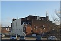
69 photos from this area
Area Information
Key information about the M19 3NQ including its size, population, and administrative classification.
- Area Type
- Postcode
- Area Size
- 5624 m²
- Population
- 2556
- Population Density
- 9686 people/km²
House Prices in M19 3NQ
34
Properties
£134,913
Average Sold Price
£16,500
Lowest Price
£320,000
Highest Price
Showing 34 properties
| Address | Type | Beds | Baths | Last Sale Price | Last Sale Date | |
|---|---|---|---|---|---|---|
| 28 Delamere Road, Manchester, M19 3NQ | Terraced | 3 | 1 | £320,000 | Aug 2025 | |
| 62 Delamere Road, Manchester, M19 3NQ | house | 3 | 1 | £189,500 | Oct 2024 | |
| 22 Delamere Road, Manchester, M19 3NQ | Terraced | - | - | £240,000 | Feb 2023 | |
| 38 Delamere Road, Manchester, M19 3NQ | Terraced | 3 | 1 | £315,000 | Mar 2022 | |
| 48 Delamere Road, Manchester, M19 3NQ | Terraced | 3 | 1 | £238,750 | Mar 2021 | |
| 2 Delamere Road, Manchester, M19 3NQ | Terraced | 3 | 1 | £210,000 | Mar 2021 | |
| 24 Delamere Road, Manchester, M19 3NQ | Terraced | - | - | £124,000 | Jun 2019 | |
| 30 Delamere Road, Manchester, M19 3NQ | house | - | - | £142,500 | Aug 2017 | |
| 66 Delamere Road, Manchester, M19 3NQ | Terraced | 3 | 1 | £134,000 | Nov 2016 | |
| 60 Delamere Road, Manchester, M19 3NQ | Terraced | 3 | 1 | £150,000 | Mar 2016 |
Page 1 of 4
Energy Efficiency in M19 3NQ
Amenities
Schools
| Rank | School | Type | Entry gender | Ages |
|---|
Explore more schools in this area
Go to Schools tabDemographics
Household Size
Family (3-5 people)
most common
Accommodation Type
Houses
most common
Tenure
48
majority
Ethnic Group
asian_total
most common
Religion
N/A
most common
Household Composition
N/A
most common
Age
47
median
Adults (30-64 years)
most common
Household Deprivation
N/A
with no deprivation
NS-SEC
27
in Lower managerial occupations
Explore more demographic insights in this area
Go to Demographics tabPlanning
Planning Constraints
- Flood RiskPremium
- Ramsar Wetland SitesPremium
- Area of Outstanding Natural BeautyPremium
- Protected Nature ReservePremium
- Protected WoodlandPremium