Area Overview for M19 3DR
Photos of M19 3DR


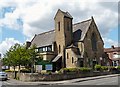
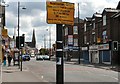
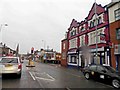


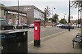

100 photos from this area
Area Information
Key information about the M19 3DR including its size, population, and administrative classification.
- Area Type
- Postcode
- Area Size
- 8607 m²
- Population
- 2512
- Population Density
- 291864 people/km²
House Prices in M19 3DR
42
Properties
£101,961
Average Sold Price
£20,000
Lowest Price
£230,000
Highest Price
Showing 42 properties
| Address | Type | Beds | Baths | Last Sale Price | Last Sale Date | |
|---|---|---|---|---|---|---|
| 8 St Oswalds Road, Manchester, M19 3DR | house | - | - | £185,000 | Sep 2023 | |
| 30 St Oswalds Road, Manchester, M19 3DR | Terraced | 3 | 1 | £230,000 | Mar 2021 | |
| 17 St Oswalds Road, Manchester, M19 3DR | Semi-detached | 3 | 1 | £165,000 | Feb 2018 | |
| 26 St Oswalds Road, Manchester, M19 3DR | Terraced | 3 | 1 | £181,950 | Feb 2018 | |
| 46 St Oswalds Road, Manchester, M19 3DR | house | - | - | £125,000 | Dec 2017 | |
| 32 St Oswalds Road, Manchester, M19 3DR | house | - | - | £125,000 | Oct 2017 | |
| 16 St Oswalds Road, Manchester, M19 3DR | Terraced | 2 | 1 | £137,000 | Jun 2017 | |
| 42 St Oswalds Road, Manchester, M19 3DR | Terraced | 2 | 1 | £85,000 | Apr 2014 | |
| 18 St Oswalds Road, Manchester, M19 3DR | Terraced | 2 | 1 | £81,500 | Dec 2013 | |
| 12 St Oswalds Road, Manchester, M19 3DR | Terraced | 2 | 1 | £65,000 | Nov 2013 |
Page 1 of 5
Energy Efficiency in M19 3DR
Amenities
Schools
| Rank | School | Type | Entry gender | Ages |
|---|
Explore more schools in this area
Go to Schools tabDemographics
Household Size
Family (3-5 people)
most common
Accommodation Type
Houses
most common
Tenure
47
majority
Ethnic Group
asian_total
most common
Religion
N/A
most common
Household Composition
N/A
most common
Age
47
median
Adults (30-64 years)
most common
Household Deprivation
N/A
with no deprivation
NS-SEC
24
in Lower managerial occupations
Explore more demographic insights in this area
Go to Demographics tabPlanning
Planning Constraints
- Flood RiskPremium
- Ramsar Wetland SitesPremium
- Area of Outstanding Natural BeautyPremium
- Protected Nature ReservePremium
- Protected WoodlandPremium