Area Overview for M19 3DB
Photos of M19 3DB
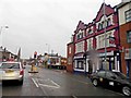
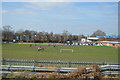

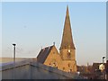
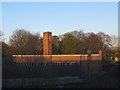
100 photos from this area
Area Information
Key information about the M19 3DB including its size, population, and administrative classification.
- Area Type
- Postcode
- Area Size
- 4447 m²
- Population
- 2512
- Population Density
- 18390 people/km²
House Prices in M19 3DB
36
Properties
£135,507
Average Sold Price
£29,000
Lowest Price
£312,000
Highest Price
Showing 36 properties
| Address | Type | Beds | Baths | Last Sale Price | Last Sale Date | |
|---|---|---|---|---|---|---|
| 41 Barlow Road, Manchester, M19 3DB | Terraced | 3 | 1 | £312,000 | Nov 2024 | |
| 47 Barlow Road, Manchester, M19 3DB | Terraced | 4 | 2 | £200,000 | Jan 2024 | |
| 33 Barlow Road, Manchester, M19 3DB | Terraced | 3 | 1 | £310,000 | Dec 2023 | |
| 59 Barlow Road, Manchester, M19 3DB | house | - | - | £200,000 | Apr 2023 | |
| 49 Barlow Road, Manchester, M19 3DB | Terraced | 4 | 1 | £245,000 | Nov 2021 | |
| 45 Barlow Road, Manchester, M19 3DB | Terraced | 3 | 1 | £239,500 | Apr 2021 | |
| 43 Barlow Road, Manchester, M19 3DB | Terraced | 3 | 1 | £186,000 | Apr 2020 | |
| 75 Barlow Road, Manchester, M19 3DB | Terraced | 4 | 1 | £176,500 | Dec 2019 | |
| 73 Barlow Road, Manchester, M19 3DB | Terraced | 4 | 1 | £140,000 | Oct 2019 | |
| 21 Barlow Road, Manchester, M19 3DB | Terraced | 2 | 2 | £138,000 | Jul 2017 |
Page 1 of 4
Energy Efficiency in M19 3DB
Amenities
Schools
| Rank | School | Type | Entry gender | Ages |
|---|
Explore more schools in this area
Go to Schools tabDemographics
Household Size
Family (3-5 people)
most common
Accommodation Type
Houses
most common
Tenure
47
majority
Ethnic Group
asian_total
most common
Religion
N/A
most common
Household Composition
N/A
most common
Age
47
median
Adults (30-64 years)
most common
Household Deprivation
N/A
with no deprivation
NS-SEC
24
in Lower managerial occupations
Explore more demographic insights in this area
Go to Demographics tabPlanning
Planning Constraints
- Flood RiskPremium
- Ramsar Wetland SitesPremium
- Area of Outstanding Natural BeautyPremium
- Protected Nature ReservePremium
- Protected WoodlandPremium