Area Overview for M19 2LN
Photos of M19 2LN
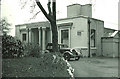
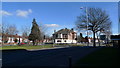
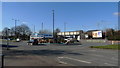
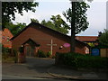


31 photos from this area
Area Information
Key information about the M19 2LN including its size, population, and administrative classification.
- Area Type
- Postcode
- Area Size
- 1.0 hectares
- Population
- 2053
- Population Density
- 6451 people/km²
House Prices in M19 2LN
17
Properties
£198,321
Average Sold Price
£42,500
Lowest Price
£330,000
Highest Price
Showing 17 properties
| Address | Type | Beds | Baths | Last Sale Price | Last Sale Date | |
|---|---|---|---|---|---|---|
| 105 Kingsway, Manchester, M19 2LN | Semi-detached | 3 | 1 | £315,000 | Mar 2025 | |
| 103 Kingsway, Manchester, M19 2LN | Semi-detached | 3 | 1 | £275,000 | Jan 2024 | |
| 109 Kingsway, Manchester, M19 2LN | house | 3 | - | £330,000 | Sep 2022 | |
| 101 Kingsway, Manchester, M19 2LN | Semi-detached | 3 | 1 | £318,500 | Mar 2022 | |
| 131 Kingsway, Manchester, M19 2LN | Detached | 5 | 2 | £247,500 | Mar 2018 | |
| 117 Kingsway, Manchester, M19 2LN | Semi-detached | 3 | 1 | £225,000 | Dec 2017 | |
| 129 Kingsway, Manchester, M19 2LN | Semi-detached | 3 | 2 | £259,000 | Nov 2017 | |
| 123 Kingsway, Manchester, M19 2LN | Semi-detached | 3 | 1 | £190,000 | Jun 2015 | |
| 111 Kingsway, Manchester, M19 2LN | house | - | - | £128,000 | Nov 2012 | |
| 127 Kingsway, Manchester, M19 2LN | Semi-detached | 3 | 1 | £163,000 | Jul 2004 |
Page 1 of 2
Energy Efficiency in M19 2LN
Amenities
Schools
| Rank | School | Type | Entry gender | Ages |
|---|
Explore more schools in this area
Go to Schools tabDemographics
Household Size
Family (3-5 people)
most common
Accommodation Type
Houses
most common
Tenure
80
majority
Ethnic Group
White
most common
Religion
N/A
most common
Household Composition
N/A
most common
Age
47
median
Adults (30-64 years)
most common
Household Deprivation
N/A
with no deprivation
NS-SEC
35
in Lower managerial occupations
Explore more demographic insights in this area
Go to Demographics tabPlanning
Planning Constraints
- Flood RiskPremium
- Ramsar Wetland SitesPremium
- Area of Outstanding Natural BeautyPremium
- Protected Nature ReservePremium
- Protected WoodlandPremium