Area Overview for M19 1TF
Photos of M19 1TF
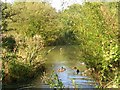
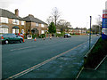


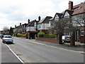
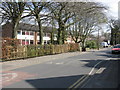

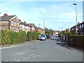

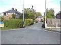

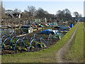
34 photos from this area
Area Information
Key information about the M19 1TF including its size, population, and administrative classification.
- Area Type
- Postcode
- Area Size
- 1.9 hectares
- Population
- 2003
- Population Density
- 6888 people/km²
House Prices in M19 1TF
19
Properties
£135,611
Average Sold Price
£39,500
Lowest Price
£271,000
Highest Price
Showing 19 properties
| Address | Type | Beds | Baths | Last Sale Price | Last Sale Date | |
|---|---|---|---|---|---|---|
| 655 Burnage Lane, Heaton Mersey, Manchester, M19 1TF | Terraced | 2 | 1 | £185,000 | Sep 2020 | |
| 647 Burnage Lane, Heaton Mersey, Manchester, M19 1TF | house | - | - | £271,000 | Oct 2019 | |
| 661 Burnage Lane, Heaton Mersey, Manchester, M19 1TF | Semi-detached | 2 | 1 | £169,950 | May 2015 | |
| 643 Burnage Lane, Heaton Mersey, Manchester, M19 1TF | Terraced | 3 | 1 | £205,000 | Jan 2015 | |
| 663 Burnage Lane, Heaton Mersey, Manchester, M19 1TF | Semi-detached | 2 | 1 | £153,000 | Oct 2013 | |
| 659 Burnage Lane, Heaton Mersey, Manchester, M19 1TF | Detached | - | - | £192,000 | Nov 2006 | |
| 645 Burnage Lane, Heaton Mersey, Manchester, M19 1TF | house | - | - | £153,129 | Dec 2005 | |
| 641A Burnage Lane, Manchester, M19 1TF | Semi-detached | - | - | £59,950 | Dec 2001 | |
| 639 Burnage Lane, Manchester, M19 1TF | house | - | - | £55,500 | Jan 2001 | |
| 637 Burnage Lane, Manchester, M19 1TF | Semi-detached | - | - | £87,000 | Aug 2000 |
Page 1 of 2
Energy Efficiency in M19 1TF
Amenities
Schools
| Rank | School | Type | Entry gender | Ages |
|---|
Explore more schools in this area
Go to Schools tabDemographics
Household Size
Family (3-5 people)
most common
Accommodation Type
Houses
most common
Tenure
70
majority
Ethnic Group
White
most common
Religion
N/A
most common
Household Composition
N/A
most common
Age
47
median
Adults (30-64 years)
most common
Household Deprivation
N/A
with no deprivation
NS-SEC
43
in Lower managerial occupations
Explore more demographic insights in this area
Go to Demographics tabPlanning
Planning Constraints
- Flood RiskPremium
- Ramsar Wetland SitesPremium
- Area of Outstanding Natural BeautyPremium
- Protected Nature ReservePremium
- Protected WoodlandPremium