Area Overview for M19 1PW
Photos of M19 1PW

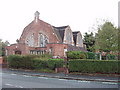
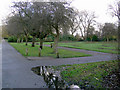
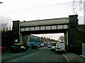
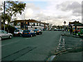
49 photos from this area
Area Information
Key information about the M19 1PW including its size, population, and administrative classification.
- Area Type
- Postcode
- Area Size
- 7227 m²
- Population
- 1574
- Population Density
- 6870 people/km²
House Prices in M19 1PW
18
Properties
£165,419
Average Sold Price
£65,000
Lowest Price
£260,000
Highest Price
Showing 18 properties
| Address | Type | Beds | Baths | Last Sale Price | Last Sale Date | |
|---|---|---|---|---|---|---|
| 346 Kingsway, Manchester, M19 1PW | Terraced | 3 | 1 | £260,000 | May 2023 | |
| 348 Kingsway, Manchester, M19 1PW | house | - | - | £208,000 | Mar 2023 | |
| 360 Kingsway, Manchester, M19 1PW | house | - | - | £207,000 | Apr 2019 | |
| 362 Kingsway, Manchester, M19 1PW | Semi-detached | 3 | 1 | £209,350 | Nov 2018 | |
| 350 Kingsway, Manchester, M19 1PW | Flat | - | - | £122,000 | Apr 2017 | |
| 334 Kingsway, Manchester, M19 1PW | Semi-detached | 3 | - | £162,000 | Oct 2016 | |
| 356 Kingsway, Manchester, M19 1PW | Semi-detached | - | - | £65,000 | Mar 2004 | |
| 366 Kingsway, Manchester, M19 1PW | house | - | - | £90,000 | Aug 2003 | |
| 344 Kingsway, Manchester, M19 1PW | Flat | - | - | - | - | |
| 340 Kingsway, Manchester, M19 1PW | house | - | - | - | - |
Page 1 of 2
Energy Efficiency in M19 1PW
Amenities
Schools
| Rank | School | Type | Entry gender | Ages |
|---|
Explore more schools in this area
Go to Schools tabDemographics
Household Size
Family (3-5 people)
most common
Accommodation Type
Houses
most common
Tenure
49
majority
Ethnic Group
White
most common
Religion
N/A
most common
Household Composition
N/A
most common
Age
47
median
Adults (30-64 years)
most common
Household Deprivation
N/A
with no deprivation
NS-SEC
31
in Lower managerial occupations
Explore more demographic insights in this area
Go to Demographics tabPlanning
Planning Constraints
- Flood RiskPremium
- Ramsar Wetland SitesPremium
- Area of Outstanding Natural BeautyPremium
- Protected Nature ReservePremium
- Protected WoodlandPremium