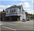
Area Overview for M18 8ZJ
Photos of M18 8ZJ


Area Information
Living in M18 8ZJ means being part of a small, tightly knit residential cluster in England, home to 1,860 people. This area is defined by its compact size and proximity to key urban infrastructure. The community is predominantly composed of adults aged 30–64, with a median age of 47, suggesting a mature, settled population. Daily life here is shaped by practical connectivity: residents have access to multiple railway stations, including Ryders Brow, Belle Vue, and Gorton, as well as metro stops at Edge Lane and Cemetery Road. The broadband score of 99 ensures seamless digital access, though mobile coverage scores at 85 are good but not exceptional. While the area has no protected natural sites or flood risks, it does face a critical safety challenge: crime rates are above average, with a safety score of 0/100. Despite this, the presence of five retail outlets, including Tesco Manchester and Aldi Gorton, and a primary school nearby, Abbey Hey Infant School, offers convenience for families. The area’s compact nature means amenities are within practical reach, though its small size limits housing diversity.
- Area Type
- Postcode
- Area Size
- Not available
- Population
- 1860
- Population Density
- 12568 people/km²
The property market in M18 8ZJ is characterised by a 31% home ownership rate, indicating that the majority of properties are rented out. This suggests a rental-focused market, possibly driven by local employment opportunities or proximity to urban centres. The accommodation type is primarily houses, which is notable for a small postcode area, implying a mix of semi-detached or terraced housing. For buyers, this means the housing stock is limited in scale, with few new developments likely. The small size of the area also means that property searches must extend to nearby postcode clusters. The low home ownership rate may reflect affordability challenges or a transient population, making the market competitive for those seeking long-term ownership. Buyers should consider the limited housing diversity and potential rental demand when evaluating properties.
House Prices in M18 8ZJ
No properties found in this postcode.
Energy Efficiency in M18 8ZJ
The lifestyle in M18 8ZJ is shaped by its proximity to retail, transport, and community hubs. Residents have access to five retail outlets, including major chains like Tesco Manchester and Aldi Gorton, ensuring everyday shopping needs are met. The area’s rail and metro stations, such as Ryders Brow and Gorton, provide easy access to urban centres for leisure, work, or socialising. While specific parks or leisure facilities are not listed, the presence of multiple transport links suggests nearby recreational spaces are within reach. The compact nature of the area means amenities are clustered closely, offering convenience for daily errands. However, the absence of detailed data on dining or cultural venues means further research is needed to fully understand the local character.
Amenities
Schools
The nearest school to M18 8ZJ is Abbey Hey Infant School, a primary institution serving young children. No secondary schools are listed in the data, meaning families may need to look beyond the immediate area for secondary education. The presence of a primary school is a key factor for families with young children, offering convenience for drop-offs and pickups. However, the absence of secondary schools nearby could pose logistical challenges, requiring reliance on transport links to larger towns or cities. The school’s type and performance are not specified in the data, so prospective families should investigate further for detailed Ofsted ratings or academic outcomes.
| Rank | School | Type | Entry gender | Ages |
|---|
Explore more schools in this area
Go to Schools tabDemographics
The community in M18 8ZJ is predominantly composed of adults aged 30–64, with a median age of 47. This suggests a population skewed toward middle-aged residents, likely including families and professionals. Home ownership is relatively low at 31%, indicating that a significant portion of the area is occupied by renters. The accommodation type is primarily houses, which is unusual for a postcode area of this size, suggesting a mix of semi-detached or terraced housing. The predominant ethnic group is White, with no data provided on other demographics. The low home ownership rate may reflect a rental market influenced by local employment patterns or housing supply constraints. While the area lacks specific data on deprivation, the combination of a mature population and limited home ownership could imply a mix of long-term residents and transient workers.
Household Size
Accommodation Type
Tenure
Ethnic Group
Religion
Household Composition
Age
Household Deprivation
NS-SEC
Explore more demographic insights in this area
Go to Demographics tabPlanning
Planning Constraints
- Flood RiskPremium
- Ramsar Wetland SitesPremium
- Area of Outstanding Natural BeautyPremium
- Protected Nature ReservePremium
- Protected WoodlandPremium