Area Overview for M18 8EQ
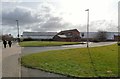
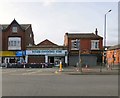
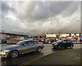
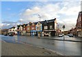
Photos of M18 8EQ


Area Information
M18 8EQ is a compact residential postcode in England, spanning just 4.2 hectares and home to 2,896 people. Its high population density of 68,636 people per square kilometre suggests a tightly knit community, though the area’s small size means it is likely a cluster of closely spaced homes rather than a sprawling suburb. This postcode is not a traditional town or village but a focused residential zone, likely integrated into a larger urban or semi-urban setting. Daily life here would revolve around nearby amenities, schools, and transport links, with residents relying on proximity to services rather than expansive local parks or open spaces. The area’s demographics—predominantly White residents aged 30–64—hint at a mature, stable population, though the high population density may create a sense of closeness among neighbours. For those considering homes in M18 8EQ, the key factors will be the availability of nearby schools, transport options, and the balance between private and rental housing in a small, defined space.
- Area Type
- Postcode
- Area Size
- 4.2 hectares
- Population
- 2896
- Population Density
- 3938 people/km²
The property market in M18 8EQ is characterised by a low home ownership rate of 38%, suggesting that a majority of properties are rented rather than owned. This could indicate a reliance on private rental housing or social housing, which may affect the availability of long-term buy-to-let opportunities. The accommodation type is primarily houses, which is notable in a high-density area, potentially pointing to a mix of small detached or semi-detached homes. This contrasts with typical urban high-rise or apartment-dominated markets, implying a focus on family-oriented housing. For buyers, this means the area may offer fewer high-end properties and more modest homes, though the small size of the postcode means the local market is likely limited in scope. Prospective buyers should consider the balance between rental demand and the potential for property value growth in such a compact, defined space.
House Prices in M18 8EQ
Showing 6 properties
| Address | Type | Beds | Baths | Last Sale Price | Last Sale Date | |
|---|---|---|---|---|---|---|
| Hammerstone Road Depot, Hammerstone Road, Manchester, M18 8EQ | Office | - | - | - | - | |
| B1 Coca Cola Building, Hammerstone Road Depot, Hammerstone Road, Manchester, M18 8EQ | Office | - | - | - | - | |
| Fleet Hire, Hammerstone Road Depot, Hammerstone Road, Manchester, M18 8EQ | warehouse | - | - | - | - | |
| B2 Factory Workshops, Hammerstone Road Depot, Hammerstone Road, Manchester, M18 8EQ | Industrial | - | - | - | - | |
| Security Cabin, Hammerstone Road Depot, Hammerstone Road, Manchester, M18 8EQ | Office | - | - | - | - | |
| B4 Gm Waste, Hammerstone Road Depot, Hammerstone Road, Manchester, M18 8EQ | Industrial | - | - | - | - |
Energy Efficiency in M18 8EQ
Residents of M18 8EQ have access to a range of local amenities, including retail options such as Aldi Gorton, Spar, and Tesco Manchester, which provide everyday shopping convenience. The proximity to multiple railway stations and metro stops ensures easy access to urban centres, while the bus station at Chorlton Street offers additional transport flexibility. Though the area lacks large parks or recreational spaces, its compact size means residents can reach nearby green spaces or leisure facilities within a short distance. The presence of schools, shops, and transport hubs contributes to a functional, community-oriented lifestyle. However, the high population density may mean limited private outdoor space, requiring residents to rely on shared or public areas for recreation. The mix of retail and transport options supports a practical, accessible daily life, though the area’s small footprint may limit the variety of leisure activities available on-site.
Amenities
Schools
Residents of M18 8EQ have access to a range of schools, including All Saints Primary School and St Francis RC Primary School, both of which are rated ‘good’ by Ofsted. These primary schools provide options for families seeking established, locally based education. Gorton Brook School, a special needs school, and Manchester KS3 and 4 PRU, which serves students with additional learning needs, cater to more specific educational requirements. Progress Schools – Gorton, an independent institution, has a ‘satisfactory’ Ofsted rating, offering an alternative to state-run schools. The variety of school types—primary, special, and independent—means families can choose between mainstream education, specialist support, or independent schooling. However, the absence of secondary schools in the immediate area may require students to commute to nearby districts for higher education, a factor to consider for long-term family planning.
| Rank | School | Type | Entry gender | Ages |
|---|
Explore more schools in this area
Go to Schools tabDemographics
The community in M18 8EQ is predominantly composed of adults aged 30–64, with a median age of 47. This suggests a population skewed towards middle-aged individuals, potentially including families with children or professionals in established careers. Home ownership rates here are relatively low at 38%, indicating that a significant portion of residents are likely renters, which may influence the local housing market dynamics. The accommodation type is primarily houses, which is unusual for a high-density area, implying a mix of single-family homes and possibly small terraced properties. The predominant ethnic group is White, though no specific data on diversity or deprivation levels is provided. The age profile and home ownership statistics suggest a community that may prioritise stability over rapid growth, with residents potentially seeking a balance between affordability and proximity to essential services.
Household Size
Accommodation Type
Tenure
Ethnic Group
Religion
Household Composition
Age
Household Deprivation
NS-SEC
Explore more demographic insights in this area
Go to Demographics tabPlanning
Planning Constraints
- Flood RiskPremium
- Ramsar Wetland SitesPremium
- Area of Outstanding Natural BeautyPremium
- Protected Nature ReservePremium
- Protected WoodlandPremium