Area Overview for M18 7WQ
Photos of M18 7WQ
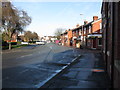
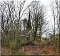
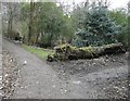
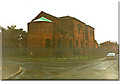
78 photos from this area
Area Information
Key information about the M18 7WQ including its size, population, and administrative classification.
- Area Type
- Postcode
- Area Size
- 1.1 hectares
- Population
- 1422
- Population Density
- 5702 people/km²
House Prices in M18 7WQ
34
Properties
£116,250
Average Sold Price
£20,000
Lowest Price
£230,000
Highest Price
Showing 34 properties
| Address | Type | Beds | Baths | Last Sale Price | Last Sale Date | |
|---|---|---|---|---|---|---|
| 183 Holmcroft Road, Manchester, M18 7WQ | house | - | - | £95,000 | Mar 2025 | |
| 147 Holmcroft Road, Manchester, M18 7WQ | Terraced | 3 | 2 | £230,000 | Jan 2025 | |
| 175 Holmcroft Road, Manchester, M18 7WQ | house | 2 | - | £168,000 | Sep 2022 | |
| 179 Holmcroft Road, Manchester, M18 7WQ | Semi-detached | 3 | 1 | £139,000 | Aug 2019 | |
| 189 Holmcroft Road, Manchester, M18 7WQ | Semi-detached | 3 | - | £84,000 | Jul 2014 | |
| 149 Holmcroft Road, Manchester, M18 7WQ | Terraced | 3 | 1 | £92,000 | May 2007 | |
| 143 Holmcroft Road, Manchester, M18 7WQ | house | - | - | £102,000 | Nov 2006 | |
| 187 Holmcroft Road, Manchester, M18 7WQ | Semi-detached | - | - | £20,000 | Jul 1996 | |
| 165 Holmcroft Road, Manchester, M18 7WQ | house | - | - | - | - | |
| 191 Holmcroft Road, Manchester, M18 7WQ | house | - | - | - | - |
Page 1 of 4
Energy Efficiency in M18 7WQ
Amenities
Schools
| Rank | School | Type | Entry gender | Ages |
|---|
Explore more schools in this area
Go to Schools tabDemographics
Household Size
Family (3-5 people)
most common
Accommodation Type
Houses
most common
Tenure
40
majority
Ethnic Group
black_total
most common
Religion
N/A
most common
Household Composition
N/A
most common
Age
22
median
Adults (30-64 years)
most common
Household Deprivation
N/A
with no deprivation
NS-SEC
26
in Lower managerial occupations
Explore more demographic insights in this area
Go to Demographics tabPlanning
Planning Constraints
- Flood RiskPremium
- Ramsar Wetland SitesPremium
- Area of Outstanding Natural BeautyPremium
- Protected Nature ReservePremium
- Protected WoodlandPremium