Area Overview for M18 7AQ
Photos of M18 7AQ
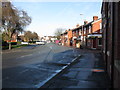
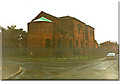
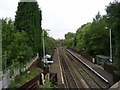
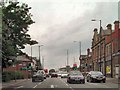
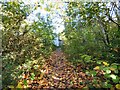
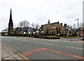
78 photos from this area
Area Information
Key information about the M18 7AQ including its size, population, and administrative classification.
- Area Type
- Postcode
- Area Size
- 2755 m²
- Population
- 2127
- Population Density
- 9309 people/km²
House Prices in M18 7AQ
32
Properties
£53,527
Average Sold Price
£19,000
Lowest Price
£135,000
Highest Price
Showing 32 properties
| Address | Type | Beds | Baths | Last Sale Price | Last Sale Date | |
|---|---|---|---|---|---|---|
| 28 Bakewell Street, Manchester, M18 7AQ | Terraced | 2 | 1 | £134,000 | Mar 2025 | |
| 26 Bakewell Street, Manchester, M18 7AQ | Terraced | 2 | 1 | £135,000 | Jan 2025 | |
| 47 Bakewell Street, Manchester, M18 7AQ | Terraced | 2 | 1 | £130,000 | Jun 2023 | |
| 30 Bakewell Street, Manchester, M18 7AQ | house | 2 | 1 | £89,000 | Nov 2019 | |
| 29 Bakewell Street, Manchester, M18 7AQ | Terraced | 2 | 1 | £82,500 | Aug 2018 | |
| 34 Bakewell Street, Manchester, M18 7AQ | Terraced | 2 | 1 | £49,500 | Aug 2015 | |
| 40 Bakewell Street, Manchester, M18 7AQ | house | 2 | 1 | £52,500 | Apr 2015 | |
| 51 Bakewell Street, Manchester, M18 7AQ | house | - | - | £42,000 | Mar 2014 | |
| 27 Bakewell Street, Manchester, M18 7AQ | house | 2 | 1 | £60,000 | Jan 2012 | |
| 44 Bakewell Street, Manchester, M18 7AQ | Terraced | 2 | 1 | £50,000 | Apr 2011 |
Page 1 of 4
Energy Efficiency in M18 7AQ
Amenities
Schools
| Rank | School | Type | Entry gender | Ages |
|---|
Explore more schools in this area
Go to Schools tabDemographics
Household Size
Family (3-5 people)
most common
Accommodation Type
Houses
most common
Tenure
19
majority
Ethnic Group
White
most common
Religion
N/A
most common
Household Composition
N/A
most common
Age
22
median
Adults (30-64 years)
most common
Household Deprivation
N/A
with no deprivation
NS-SEC
12
in Lower managerial occupations
Explore more demographic insights in this area
Go to Demographics tabPlanning
Planning Constraints
- Flood RiskPremium
- Ramsar Wetland SitesPremium
- Area of Outstanding Natural BeautyPremium
- Protected Nature ReservePremium
- Protected WoodlandPremium