Area Overview for M17 1RH
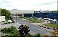
Photos of M17 1RH


Area Information
Living in M17 1RH means being part of a tightly knit residential cluster in England, home to 1,448 people spread across a compact area with a population density of 265 people per square kilometre. This postcode is defined by its small-scale character, where daily life is shaped by proximity to essential services and a mix of local amenities. The area’s residents, predominantly adults aged 30–64, reflect a community rooted in home ownership, with 80% of properties occupied by their owners. While the area lacks sprawling green spaces or major landmarks, its appeal lies in practicality—nearby shops, transport links, and schools create a self-contained environment. The presence of five rail stations, including Eccles and Patricroft, ensures easy access to Manchester’s broader network, while broadband connectivity scores at 100, making it ideal for remote work. For those seeking a balance between convenience and a quieter lifestyle, M17 1RH offers a snapshot of suburban living, though its small size means every decision about where to live here carries weight.
- Area Type
- Postcode
- Area Size
- Not available
- Population
- 1448
- Population Density
- 265 people/km²
The property market in M17 1RH is characterised by a strong emphasis on owner-occupation, with 80% of homes owned by their residents. This contrasts with areas where rental markets dominate, suggesting a community focused on long-term stability. The accommodation types here are predominantly houses, which is unusual for a postcode of this size but aligns with the area’s lower density. This housing stock may appeal to buyers seeking family-friendly properties with more space than typical flats or apartments. However, the small size of M17 1RH means the available options are limited to a few homes, and the immediate surroundings may offer more variety. For buyers, this creates a niche market where properties are likely to be in high demand, but competition could be fierce. The lack of commercial or mixed-use developments also means the area remains focused on residential living, with limited scope for investment in non-residential property.
House Prices in M17 1RH
No properties found in this postcode.
Energy Efficiency in M17 1RH
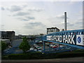
The lifestyle in M17 1RH is shaped by its proximity to a range of amenities. Residents have access to five retail outlets, including Iceland Eccles, Lidl West, and Morrisons Eccles, ensuring everyday shopping needs are met locally. The area’s five metro stops, such as Parkway and Ladywell, provide easy access to public transport, while rail stations like Eccles and Patricroft connect to wider networks. The presence of City Airport Manchester within reach adds convenience for travel. Though the area is small, its amenities reflect a balance between practicality and accessibility. The mix of retail, transport, and nearby green spaces—while not explicitly detailed—suggests a community where daily life is manageable without needing to travel far. For those who prioritise convenience over sprawling leisure options, M17 1RH offers a compact yet functional environment.
Amenities
Schools
For families in M17 1RH, nearby schools include Kingsway Primary School, which holds a good Ofsted rating, and two special schools: Urmston Parklands School and Egerton High School. The presence of a primary school with a positive rating ensures accessible, high-quality early education for young children, while the special schools cater to students with specific needs. This mix of school types reflects a community that values both mainstream and specialist education. Parents seeking a primary school with strong performance can rely on Kingsway, though the absence of secondary schools within the immediate area may require commuting. The proximity of these institutions to homes in M17 1RH suggests that schools are a key consideration for families, though the limited range of educational options means careful planning is needed for older children.
| Rank | School | Type | Entry gender | Ages |
|---|
Explore more schools in this area
Go to Schools tabDemographics
The community in M17 1RH is predominantly composed of adults aged 30–64, with a median age of 47. This suggests a mature, stable population, likely with established careers and families. Home ownership is high at 80%, indicating a strong preference for long-term residency over rental properties. The accommodation types here are primarily houses, which aligns with the area’s residential character and lower population density. The predominant ethnic group is White, reflecting a homogenous demographic profile. While no specific data on deprivation is provided, the high home ownership and age distribution imply a community with relatively stable economic conditions. However, the absence of detailed diversity metrics means the full picture of social composition remains partially obscured. For those considering M17 1RH, the demographic profile suggests a place where neighbours are likely to be familiar faces, and local needs are prioritised over transient trends.
Household Size
Accommodation Type
Tenure
Ethnic Group
Religion
Household Composition
Age
Household Deprivation
NS-SEC
Explore more demographic insights in this area
Go to Demographics tabPlanning
Planning Constraints
- Flood RiskPremium
- Ramsar Wetland SitesPremium
- Area of Outstanding Natural BeautyPremium
- Protected Nature ReservePremium
- Protected WoodlandPremium