Area Overview for M17 1PJ
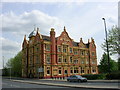
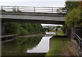
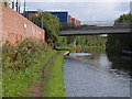
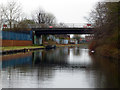
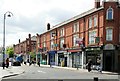
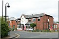
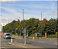
Photos of M17 1PJ


Area Information
Living in M17 1PJ means inhabiting a compact, residential postcode area in England, covering just 1.4 hectares. With a population of 1,701 people, the area is densely populated at 572 people per square kilometre, reflecting a tight-knit community. The area’s character is shaped by its proximity to major landmarks such as MediaCityUK and the Imperial War Museum, offering a blend of cultural and professional opportunities. Daily life here is defined by practicality, with residents navigating a mix of local amenities and transport links. The area’s small size means it is likely to be part of a larger neighbourhood, with homes predominantly in private ownership. While the population skews towards adults aged 30–64, the median age of 47 suggests a mature demographic, potentially influencing the pace and priorities of community life. The area’s connectivity to rail and road networks, combined with a high broadband score, positions it as a practical choice for those balancing work and home. However, the high crime risk reported here demands careful consideration for prospective buyers.
- Area Type
- Postcode
- Area Size
- 1.4 hectares
- Population
- 1701
- Population Density
- 572 people/km²
The property market in M17 1PJ is characterised by a high rate of home ownership—79% of residents own their homes. This suggests a stable, owner-occupied market rather than a rental-dominated area. The accommodation type is predominantly houses, which may appeal to buyers seeking more space and privacy compared to flats. Given the area’s small size of 1.4 hectares, the housing stock is likely limited, with properties concentrated in a compact cluster. This could mean competition for available homes, particularly for buyers looking to move into the area. The proximity to major transport hubs, such as Trafford Park Railway Station and Manchester United FC Railway Station, may enhance the area’s appeal, though the high crime risk reported here could affect property desirability. Buyers should consider both the practical advantages of the location and the need for enhanced security measures.
House Prices in M17 1PJ
No properties found in this postcode.
Energy Efficiency in M17 1PJ
Residents of M17 1PJ have access to a range of amenities within practical reach. Retail options include Co-op Taylors, Tesco Stretford, and M&S Lowry, offering everyday shopping needs. The area’s proximity to MediaCityUK and the Imperial War Museum provides cultural and professional opportunities, while nearby parks and open spaces, though not explicitly named in the data, may contribute to leisure activities. The presence of five metro locations, including the Village and MediaCityUK, suggests a mix of urban and suburban character. For dining and entertainment, the area’s links to Trafford Park and nearby stations could provide access to restaurants and cafes. The compact nature of the postcode means amenities are concentrated, offering convenience but potentially limiting diversity. The combination of retail, cultural, and transport hubs makes daily life in M17 1PJ practical, though the area’s small size may mean residents rely on nearby neighbourhoods for broader options.
Amenities
Schools
| Rank | School | Type | Entry gender | Ages |
|---|
Explore more schools in this area
Go to Schools tabDemographics
The community in M17 1PJ is predominantly composed of adults aged 30–64, with a median age of 47. This suggests a mature population, likely with established careers and family structures. Home ownership is high at 79%, indicating a stable, long-term resident base. The accommodation type is primarily houses, which aligns with the area’s residential character and may appeal to those seeking more space than flats. The predominant ethnic group is White, though no further diversity data is available. The population density of 572 people per square kilometre means the area is compact, with limited open space. This density could influence local services and amenities, but it also reflects a focused, community-oriented environment. The lack of specific data on deprivation or income levels means it is difficult to assess quality of life beyond the provided statistics.
Household Size
Accommodation Type
Tenure
Ethnic Group
Religion
Household Composition
Age
Household Deprivation
NS-SEC
Explore more demographic insights in this area
Go to Demographics tabPlanning
Planning Constraints
- Flood RiskPremium
- Ramsar Wetland SitesPremium
- Area of Outstanding Natural BeautyPremium
- Protected Nature ReservePremium
- Protected WoodlandPremium