Area Overview for M17 1FA
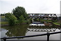
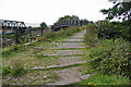
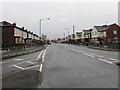
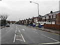
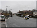
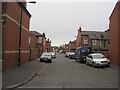
Photos of M17 1FA


Area Information
Living in M17 1FA means being part of a tightly knit residential cluster in north-west England. The area spans just 13.2 hectares, housing 2,599 people in a dense urban environment with a population density of 19,751 people per square kilometre. This compact postcode is characterised by a mature community, with a median age of 47 and a majority of residents aged between 30 and 64. The housing stock here is predominantly owner-occupied, with 55% of homes owned outright, and the accommodation type is largely houses rather than flats. Daily life in M17 1FA is shaped by proximity to key amenities, including schools, transport hubs, and retail outlets. While the area is small, it sits near major landmarks like Old Trafford and Manchester United FC railway station, offering a blend of urban convenience and local character. For those seeking a place to settle, M17 1FA provides a focused, community-driven environment with clear access to essential services.
- Area Type
- Postcode
- Area Size
- 13.2 hectares
- Population
- 2599
- Population Density
- 3214 people/km²
The property market in M17 1FA is dominated by owner-occupied homes, with 55% of properties in private hands. The accommodation type is predominantly houses, which contrasts with areas where flats or apartments dominate. This suggests a market skewed towards family homes and long-term residency rather than short-term rental properties. Given the area’s small size—just 13.2 hectares—the housing stock is limited, which could mean competition for available properties. Buyers should consider that the area’s compact nature may restrict options, though proximity to schools, transport, and amenities could offset this. The high population density also implies that properties are likely to be closely spaced, with little scope for expansion. For those seeking a home in M17 1FA, the focus is on securing a house in a mature, established community with clear access to essential services.
House Prices in M17 1FA
No properties found in this postcode.
Energy Efficiency in M17 1FA
Residents of M17 1FA enjoy a range of amenities within easy reach, enhancing daily life. The area’s retail options include Co-op Taylors, Lidl Stretford, and Tesco Stretford, providing convenience for grocery shopping and everyday needs. For transport, the nearby railway stations—Trafford Park, Manchester United FC, and Humphrey Park—offer frequent services, while the metro stops at Village and Old Trafford connect to major landmarks. The proximity to City Airport Manchester is a notable advantage for frequent travellers. Leisure and cultural opportunities are also accessible, with the Imperial War Museum and Old Trafford stadium nearby. The mix of retail, transport, and leisure facilities means residents can manage errands, commute efficiently, and enjoy local attractions without long journeys. This blend of practicality and accessibility contributes to a lifestyle that balances urban convenience with community-oriented living.
Amenities
Schools
Residents of M17 1FA have access to two primary schools within practical reach: Gorse Hill Primary School and Stretford High School, both rated ‘good’ by Ofsted. These institutions provide a foundation for early education and are likely to be key considerations for families. The presence of two primary schools suggests a focus on local education, though no secondary schools are listed in the data. For parents, this means children can attend primary education without long commutes. The ‘good’ Ofsted ratings indicate that both schools meet or exceed national standards in teaching quality and student outcomes. However, the absence of secondary school data means families may need to look further afield for secondary education. The availability of two primary schools with strong ratings is a clear advantage for those prioritising educational quality in their choice of area.
| Rank | School | Type | Entry gender | Ages |
|---|
Explore more schools in this area
Go to Schools tabDemographics
The population of M17 1FA skews towards adults aged 30 to 64, with a median age of 47. This suggests a community with a strong presence of middle-aged residents, likely including families and professionals. Home ownership is significant, with 55% of properties owned by their occupants, indicating a stable, long-term demographic. The predominant ethnic group is White, though no further breakdown of diversity is provided. The high population density of 19,751 people per square kilometre reflects the area’s compact nature, which can influence the pace of daily life. While this density ensures proximity to amenities, it may also mean limited private outdoor space. The age profile suggests a community with established routines, potentially prioritising stability over transient lifestyles. This demographic structure shapes the area’s character, with a focus on local services and a relatively mature, settled population.
Household Size
Accommodation Type
Tenure
Ethnic Group
Religion
Household Composition
Age
Household Deprivation
NS-SEC
Explore more demographic insights in this area
Go to Demographics tabPlanning
Planning Constraints
- Flood RiskPremium
- Ramsar Wetland SitesPremium
- Area of Outstanding Natural BeautyPremium
- Protected Nature ReservePremium
- Protected WoodlandPremium