Area Overview for M16 9UA
Photos of M16 9UA


Area Information
Living in M16 9UA means inhabiting a compact, densely populated area of just 1.5 hectares, home to 1,990 residents. The postcode’s small size creates a tightly knit community, where proximity to amenities and services is a defining feature. With a median age of 47 and a population skewed toward adults aged 30–64, the area reflects a mature, established demographic. The predominant ethnic group is Asian, shaping the cultural and social fabric of the neighbourhood. Daily life here is characterised by proximity to transport hubs and retail options, though the area’s limited size means residents must navigate shared spaces and resources. Despite its constraints, M16 9UA offers a blend of residential stability and connectivity, with homes primarily in single-family structures. The high population density—136,684 people per square kilometre—underscores the area’s role as a densely lived-in postcode, where community interaction is frequent and local services are within easy reach.
- Area Type
- Postcode
- Area Size
- 1.5 hectares
- Population
- 1990
- Population Density
- 3297 people/km²
The property market in M16 9UA is shaped by its high population density and the predominance of houses. With 41% of residents owning their homes, the area is not a typical owner-occupied postcode but rather one where rental demand is significant. The presence of single-family homes suggests a mix of older properties, possibly semi-detached or terraced houses, which may appeal to families or individuals seeking more space in a compact setting. Given the area’s limited size, property availability is constrained, and buyers should consider the proximity to shared amenities and transport links. The low home ownership rate may indicate a rental market dominated by landlords, which could affect property prices and investment potential. For buyers, the challenge lies in securing a home within a small geographical footprint, where competition for space may be intense.
House Prices in M16 9UA
No properties found in this postcode.
Energy Efficiency in M16 9UA
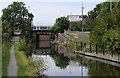
The lifestyle in M16 9UA is shaped by its proximity to a range of amenities. Retail options include Iceland Old, Co-op Salford, and Iceland White, providing everyday shopping convenience. Metro stations like Pomona and Trafford Bar offer access to urban hubs, while rail services at Manchester United FC Railway Station and Trafford Park Railway Station connect residents to broader networks. The area’s single bus stop, Chorlton Street Coach Station, complements public transport. Nearby, City Airport Manchester is within practical reach, catering to those requiring air travel. The mix of retail, transport, and connectivity options ensures residents can access essentials without long commutes. The compact nature of the area means amenities are closely clustered, fostering a sense of convenience and accessibility for daily life.
Amenities
Schools
The nearest school to M16 9UA is Seymour Park Community Primary School, which is rated outstanding by Ofsted. This primary school serves the local community, offering a high standard of education for younger children. The absence of secondary schools in the immediate vicinity means families may need to travel to nearby areas for secondary education, though the primary school’s excellence is a strong asset for parents prioritising early education. The single school listed in the data reflects the area’s focus on primary education, which may align with the demographic of older adults and families with young children. For those seeking a strong foundation in schooling, Seymour Park Community Primary School is a key consideration, though additional research would be needed for secondary options.
| Rank | School | Type | Entry gender | Ages |
|---|
Explore more schools in this area
Go to Schools tabDemographics
The population of M16 9UA is predominantly adults aged 30–64, with a median age of 47. This suggests a community of middle-aged residents, many of whom may be in their peak earning years or nearing retirement. Home ownership is relatively low at 41%, indicating a significant proportion of residents rent their homes. The area is composed mainly of houses, which is unusual for a high-density postcode, suggesting a mix of semi-detached or terraced properties. The predominant ethnic group is the Asian_total category, which influences the cultural dynamics and social cohesion of the area. While no specific deprivation data is provided, the high population density and lower home ownership rate may imply a reliance on shared resources and community support networks. The demographic profile points to a stable, established population with a strong presence of families and older adults.
Household Size
Accommodation Type
Tenure
Ethnic Group
Religion
Household Composition
Age
Household Deprivation
NS-SEC
Explore more demographic insights in this area
Go to Demographics tabPlanning
Planning Constraints
- Flood RiskPremium
- Ramsar Wetland SitesPremium
- Area of Outstanding Natural BeautyPremium
- Protected Nature ReservePremium
- Protected WoodlandPremium