Area Overview for M16 8RA
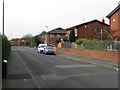
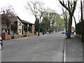
Photos of M16 8RA


Area Information
Living in M16 8RA means being part of a small, tightly knit residential cluster in England, where the population of 2226 residents creates a quiet, community-focused atmosphere. This postcode area is characterised by its modest scale and proximity to key urban amenities, making it a practical choice for those seeking a balance between suburban comfort and city access. The area’s demographics suggest a mature population, with a median age of 47 and a strong presence of adults aged 30–64. This age group often prioritises stability, reflected in the 55% home ownership rate and the predominance of houses over flats. While the area lacks sprawling green spaces, its compact size ensures easy access to nearby retail, transport hubs, and schools. Daily life here is shaped by routine commutes to Manchester’s central districts, with residents benefiting from multiple rail and metro connections. The presence of high-quality broadband and a range of local shops adds to the practicality of living in M16 8RA, though the community’s character is defined by its straightforward, no-frills approach to urban living.
- Area Type
- Postcode
- Area Size
- Not available
- Population
- 2226
- Population Density
- 5476 people/km²
The property market in M16 8RA is shaped by a 55% home ownership rate, indicating that nearly half of properties are owner-occupied, while the remaining 45% are likely rented. The predominance of houses over flats suggests a housing stock that caters to families or individuals seeking more space, though the exact proportion of rental properties is not specified. Given the area’s small size, the market is likely limited in scope, with limited scope for new developments due to planning constraints. The focus on houses may appeal to buyers prioritising space and privacy, but the compact nature of the postcode means the surrounding areas are critical for property diversity. For buyers, this means a need to consider nearby zones for broader options. The ownership rate also implies a stable market, with long-term residents less likely to move frequently. However, the lack of detailed data on property prices or availability means potential buyers must rely on local agents for up-to-date insights.
House Prices in M16 8RA
No properties found in this postcode.
Energy Efficiency in M16 8RA
The lifestyle in M16 8RA is defined by its proximity to essential amenities, from retail to transport. Local shops such as Aldi Moss, Co-op Whalley, and Tesco Whalley provide everyday convenience, while the area’s metro, rail, and bus services ensure easy movement within Manchester. The presence of multiple railway stations, including Burnage and Manchester United FC, offers direct access to the city centre and beyond. For leisure, the area’s connection to three airport access points may cater to those with travel needs, though recreational spaces are not detailed in the data. The compact nature of the postcode means daily life is centred around these immediate amenities, with little need to travel far for essentials. The mix of retail, transport, and connectivity creates a practical, functional environment, though the absence of specific parks or green spaces suggests a focus on urban convenience over natural settings. This makes M16 8RA ideal for those prioritising accessibility and efficiency over expansive outdoor areas.
Amenities
Schools
Residents of M16 8RA have access to Whalley Range 11–18 High School, which operates as both a primary and academy school. While the data does not specify Ofsted ratings, the presence of two school entries for the same name suggests a focus on secondary education, with the academy model potentially offering specialist provision. The mix of primary and academy schooling provides families with options for both early and later education, though the absence of additional schools in the data means the area relies heavily on this single institution. For parents, this could be a limitation if the school does not meet their expectations, necessitating a closer look at its performance and facilities. The proximity of the school to the postcode area underscores its role as a central amenity, but the lack of nearby alternatives means any issues with the school could impact the area’s appeal for families.
| Rank | School | Type | Entry gender | Ages |
|---|
Explore more schools in this area
Go to Schools tabDemographics
The community in M16 8RA is predominantly composed of adults aged 30–64, with a median age of 47, indicating a mature, established population. Home ownership stands at 55%, suggesting a mix of long-term residents and renters, though the data does not specify rental figures. The area is characterised by houses rather than flats, aligning with a preference for family-friendly or semi-detached living. The predominant ethnic group is the Asian community, which contributes to the area’s cultural diversity. While no specific deprivation data is provided, the age profile and ownership rates imply a population that is largely settled and economically stable. However, the absence of detailed socioeconomic breakdowns means the full picture of quality of life remains partially unexplored. The community’s structure—centred around family units and long-term occupancy—suggests a focus on continuity over rapid change, which can be both a strength and a limitation depending on individual preferences.
Household Size
Accommodation Type
Tenure
Ethnic Group
Religion
Household Composition
Age
Household Deprivation
NS-SEC
Explore more demographic insights in this area
Go to Demographics tabPlanning
Planning Constraints
- Flood RiskPremium
- Ramsar Wetland SitesPremium
- Area of Outstanding Natural BeautyPremium
- Protected Nature ReservePremium
- Protected WoodlandPremium