Area Overview for M16 8QT
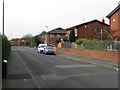
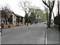
Photos of M16 8QT


Area Information
Living in M16 8QT offers a compact, residential experience shaped by its small cluster of homes and a population of 2,226 residents. This area is characterised by its modest scale, where daily life unfolds within walking distance of key amenities. The community is predominantly composed of adults aged 30–64, reflecting a mature demographic with established routines. While the area lacks sprawling landscapes or major landmarks, its proximity to transport hubs and retail centres makes it practical for commuters and families. The presence of multiple railway stations, including Burnage and Mauldeth Road, ensures connectivity to Manchester’s broader network. For those seeking a quieter lifestyle, the absence of protected natural areas or flood risks offers reassurance, though the high crime risk necessitates caution. M16 8QT is not a sprawling suburb but a tightly knit postcode where neighbours are likely to be familiar faces, and local shops and schools form the backbone of daily life.
- Area Type
- Postcode
- Area Size
- Not available
- Population
- 2226
- Population Density
- 5476 people/km²
The property market in M16 8QT is defined by its 55% home ownership rate, with houses forming the majority of accommodation types. This suggests a market skewed towards owner-occupied properties rather than rentals, though the relatively small population implies limited housing stock. The presence of houses rather than flats or apartments indicates a preference for private, standalone living spaces. For buyers, this means a focus on individual homes rather than shared or high-density developments. The area’s compact size means that property searches are likely to be confined to a narrow geographic scope, with little room for expansion. The lack of large-scale housing projects or new developments may limit options for those seeking modern or larger properties. However, the stability of the existing housing stock and the absence of environmental constraints make it a potentially secure investment, provided buyers are mindful of the high crime risk.
House Prices in M16 8QT
No properties found in this postcode.
Energy Efficiency in M16 8QT
Daily life in M16 8QT is shaped by its proximity to a range of amenities. Retailers such as Aldi Moss, Co-op Whalley, and Tesco Whalley provide essential shopping, while metro stations like Withington and St Werburgh’s Road offer quick access to urban centres. Rail stations, including Burnage and Manchester United FC, connect residents to broader transport networks, facilitating travel to work or leisure. The area’s bus services, though limited to a single coach station, complement the rail and metro options. For those needing air travel, the three nearby airport terminals ensure easy access to domestic and international destinations. The mix of retail, transport, and proximity to major hubs creates a lifestyle that balances convenience with the ability to escape to larger cities. However, the lack of parks or leisure facilities within the data suggests that outdoor activities may require travel beyond the immediate area.
Amenities
Schools
The nearest schools to M16 8QT include Whalley Range 11–18 High School, listed as both a primary school and an academy. While the data does not provide Ofsted ratings, the presence of a single school serving multiple educational stages suggests a focus on secondary education. The duplication of the school’s name and type may indicate a single institution offering both primary and academy-level education, though this requires clarification. For families, this means a reliance on a single school for children’s education, which could be a concern if the school’s capacity or quality does not meet expectations. The absence of additional schools in the data implies limited options for parents seeking alternative educational environments. However, the proximity of the school to the area’s residential cluster may reduce travel time for students.
| Rank | School | Type | Entry gender | Ages |
|---|
Explore more schools in this area
Go to Schools tabDemographics
The population of M16 8QT is 2,226, with a median age of 47 and the majority of residents falling within the 30–64 age range. This suggests a community of established adults, many of whom may be in their peak working years. Home ownership stands at 55%, indicating a balanced mix of owner-occupied properties and rental homes. The predominant accommodation type is houses, which aligns with the area’s residential character. The dominant ethnic group is Asian_total, reflecting a cultural diversity that influences local traditions and community dynamics. While the data does not specify deprivation levels, the age profile and home ownership rate suggest a stable, middle-income demographic. The absence of younger families or retirees may shape the area’s social fabric, with fewer schools catering to early childhood education. This demographic profile indicates a community focused on work and family life, with limited reliance on public services for younger or elderly populations.
Household Size
Accommodation Type
Tenure
Ethnic Group
Religion
Household Composition
Age
Household Deprivation
NS-SEC
Explore more demographic insights in this area
Go to Demographics tabPlanning
Planning Constraints
- Flood RiskPremium
- Ramsar Wetland SitesPremium
- Area of Outstanding Natural BeautyPremium
- Protected Nature ReservePremium
- Protected WoodlandPremium