Area Overview for M16 7BN
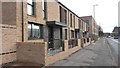
Photos of M16 7BN


Area Information
Living in M16 7BN means being part of a small residential cluster with a population of 2,911. This postcode sits in a compact area where daily life is shaped by proximity to urban infrastructure and community amenities. The area is notable for its mix of housing types and its position near key transport links. Residents benefit from nearby schools, retail outlets, and public transport options that connect to Manchester’s broader network. The community here is diverse, with Black residents forming the predominant ethnic group. While the median age is 22, the most common age range among residents is 30–64, suggesting a balance between younger professionals and established families. The area’s compact size means that essential services are within practical reach, though its small scale also means that housing stock is limited. For those considering M16 7BN, the blend of affordability, accessibility, and local facilities offers a distinct proposition for homebuyers seeking a manageable, connected living environment.
- Area Type
- Postcode
- Area Size
- Not available
- Population
- 2911
- Population Density
- 9372 people/km²
The property market in M16 7BN is dominated by rental rather than owner-occupied homes, with only 15% of households owning their properties. This suggests a market where tenants outnumber buyers, potentially limiting opportunities for long-term investment. The area’s housing stock is primarily composed of houses, which may appeal to those seeking more space or privacy. However, the small scale of the postcode means that available properties are likely limited, and competition for homes could be intense. For buyers, this small area and its immediate surroundings may offer a niche market, but the low home ownership rate indicates that securing a property here could be challenging. The focus on houses rather than flats or apartments also means that the housing stock is not as densely packed as in larger urban centres. Prospective buyers should consider the limited availability and the area’s rental-oriented nature when evaluating the market.
House Prices in M16 7BN
No properties found in this postcode.
Energy Efficiency in M16 7BN
Daily life in M16 7BN is shaped by its proximity to a variety of amenities. Retail options include Farmfoods Hulme, Asda Hulme, and Tesco Firswood, providing access to groceries and everyday essentials. Public transport hubs like Cornbrook, Trafford Bar, and Pomona metro stations, along with Deansgate and Manchester Oxford Road railway stations, offer easy connections to Manchester’s wider transport network. The nearby City Airport Manchester adds to the area’s accessibility for travel. While the data does not specify parks or leisure facilities, the presence of multiple retail and transport options suggests a functional, urban lifestyle. The area’s compact nature means that amenities are within walking or short transit distance, though residents may need to travel further for more specialised services. The mix of retail, transport, and connectivity supports a practical, convenience-driven daily routine.
Amenities
Schools
Residents of M16 7BN have access to several primary schools, including Princess Infant School, St Mary’s CofE Junior and Infant School, and Princess County Primary School. St Mary’s CofE Junior and Infant School holds an outstanding Ofsted rating, while IncludEd Learning, a special needs school, has a good rating. The presence of both mainstream and special education options provides families with a range of choices, though the area’s small size means that school catchment areas are likely tightly defined. The availability of an outstanding primary school may be a significant draw for families, but the absence of secondary schools within the immediate area could necessitate travel for older children. The mix of school types reflects a commitment to inclusive education, but parents should verify specific admissions criteria and proximity to ensure their needs are met.
| Rank | School | Type | Entry gender | Ages |
|---|
Explore more schools in this area
Go to Schools tabDemographics
The community in M16 7BN is defined by a median age of 22, though the most common age range for residents is 30–64 years. This suggests a population skewed toward older adults, possibly including retirees or long-term residents. Home ownership is low, with only 15% of households owning their homes, indicating a rental-dominated market. The area is characterised by houses as the primary accommodation type, though the exact number of properties is not specified. The predominant ethnic group is Black residents, reflecting a specific demographic profile. While no data on deprivation is provided, the low home ownership rate may imply economic pressures or a transient population. The age distribution and housing stock suggest a community where older residents may outnumber younger families, influencing local services and amenities. This profile shapes the area’s character, with a focus on established residents rather than growing families.
Household Size
Accommodation Type
Tenure
Ethnic Group
Religion
Household Composition
Age
Household Deprivation
NS-SEC
Explore more demographic insights in this area
Go to Demographics tabPlanning
Planning Constraints
- Flood RiskPremium
- Ramsar Wetland SitesPremium
- Area of Outstanding Natural BeautyPremium
- Protected Nature ReservePremium
- Protected WoodlandPremium