Area Overview for M16 0RR
Photos of M16 0RR


Area Information
Living in M16 0RR means being part of a small, tightly knit residential cluster in England, home to 2,160 people. This area is defined by its compact size and proximity to urban amenities, making it a practical choice for those seeking a balance between suburban comfort and city access. The community here is predominantly adult-focused, with the median age at 47 and most residents falling within the 30-64 age range. This demographic suggests a mature, stable population, likely drawn to the area for its established infrastructure and quiet residential character. Daily life is shaped by proximity to retail hubs, transport links, and educational institutions, ensuring convenience without the density of larger urban centres. While the area lacks sprawling green spaces, its strategic location near key transport arteries and amenities makes it a functional base for commuters and families alike. The absence of major planning constraints, such as protected woodlands or AONB designations, means development is unencumbered, though the high crime risk noted in assessments requires careful consideration. For buyers, M16 0RR offers a snapshot of a small, manageable community with clear pros and cons to weigh.
- Area Type
- Postcode
- Area Size
- Not available
- Population
- 2160
- Population Density
- 2946 people/km²
The property market in M16 0RR is characterised by a 46% home ownership rate, with houses forming the primary accommodation type. This suggests a mix of owner-occupied and rental properties, though the relatively low ownership percentage indicates a significant portion of the housing stock may be available for rent. The prevalence of houses over flats or apartments points to a suburban or semi-rural setting, which could appeal to buyers seeking more space or a quieter environment. However, the small size of the area means the housing stock is limited, potentially increasing competition among buyers. The lack of planning constraints, such as protected areas or flood risks, may make the area attractive for investment, though the high crime risk noted in assessments could deter some buyers. For those considering the area, the property market offers a blend of stability and practicality, but the small scale means buyers must act decisively.
House Prices in M16 0RR
No properties found in this postcode.
Energy Efficiency in M16 0RR
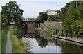
The lifestyle in M16 0RR is shaped by its proximity to a range of amenities. Retail options include Iceland White, Aldi White City Retail Park, and M&S Stretford, offering everyday shopping needs. The area’s transport links, such as Trafford Bar metro station and Manchester United FC railway station, provide easy access to the city and surrounding regions. For leisure, the nearby Old Trafford metro station and Deansgate railway station connect residents to cultural and sporting venues. The City Airport Manchester is within reach, adding to the area’s connectivity. While green spaces are not explicitly mentioned, the absence of planning constraints like protected woodlands suggests open land may be available for recreation. The mix of retail, transport, and accessibility creates a practical, convenience-driven lifestyle, ideal for those prioritising ease of movement over expansive natural landscapes.
Amenities
Schools
Residents of M16 0RR have access to two notable educational institutions. Great Stone Boys’ School is a primary school, providing early education for local children, while North Trafford College of Further Education caters to sixth-form students. This combination of primary and post-16 education ensures a continuum of schooling for families, though the absence of secondary schools in the immediate area may require commuting for older students. The presence of both institutions suggests the area is well-served for families with children at different stages of education. However, the lack of specific Ofsted ratings or performance data means potential buyers must rely on other factors when assessing the quality of local schools.
| Rank | School | Type | Entry gender | Ages |
|---|
Explore more schools in this area
Go to Schools tabDemographics
The population of M16 0RR is 2,160, with a median age of 47 and the majority of residents aged between 30 and 64. This suggests a mature, established community where homeownership is a key feature, with 46% of properties owned outright. The accommodation type is predominantly houses, which aligns with the area’s residential character and the absence of high-density housing. The predominant ethnic group is White, reflecting a homogenous demographic profile. While no specific data on deprivation is provided, the age and ownership statistics indicate a stable, middle-aged population likely with long-term ties to the area. The lack of diversity in ethnic composition may influence local culture and community dynamics, though this is not explicitly quantified. The age range also implies a population with established careers and families, which may shape local services and amenities.
Household Size
Accommodation Type
Tenure
Ethnic Group
Religion
Household Composition
Age
Household Deprivation
NS-SEC
Explore more demographic insights in this area
Go to Demographics tabPlanning
Planning Constraints
- Flood RiskPremium
- Ramsar Wetland SitesPremium
- Area of Outstanding Natural BeautyPremium
- Protected Nature ReservePremium
- Protected WoodlandPremium