Area Overview for M16 0RB
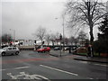
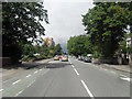
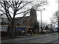
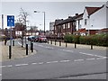
Photos of M16 0RB


Area Information
Living in M16 0RB means being part of a small, tightly knit residential cluster in England, home to 2051 residents. This postcode area is characterised by its compact size and proximity to key urban amenities. Daily life here balances quiet residential living with easy access to transport networks and retail hubs. The area’s modest population suggests a community that is neither sprawling nor overly dense, offering a sense of familiarity for those who live here. Neighbouring schools, transport links, and local shops create a functional environment for families and commuters. While the area lacks large-scale infrastructure, its strategic location near major roads and rail lines makes it a practical choice for those prioritising connectivity. The presence of a primary school with a good Ofsted rating adds to its appeal for households with children. However, the small size of the area means that housing options are limited, and buyers must consider the broader surrounding regions for more choices.
- Area Type
- Postcode
- Area Size
- Not available
- Population
- 2051
- Population Density
- 3073 people/km²
The property market in M16 0RB is defined by a 40% home ownership rate, which indicates that more than half of residents rent their homes. This suggests a rental market that may be influenced by local employment opportunities and proximity to transport links. The accommodation type is predominantly houses, which contrasts with areas where flats or apartments dominate. This housing stock may appeal to those seeking larger living spaces, though the small size of the area means the number of available properties is limited. Buyers should consider the broader surrounding regions for more options, as the immediate area offers a modest selection. The mix of owner-occupied and rented properties may affect property prices, with potential for growth if demand increases. However, the small population and limited housing stock mean the market is unlikely to be highly competitive.
House Prices in M16 0RB
No properties found in this postcode.
Energy Efficiency in M16 0RB
The lifestyle in M16 0RB is shaped by its proximity to a range of amenities. Retail options include Iceland, Aldi, and the White City Retail Park, providing access to groceries and everyday essentials. The area’s transport links connect residents to metro stops, rail stations, and the nearby City Airport Manchester, facilitating both local and long-distance travel. The presence of five rail stations, including Trafford Park Railway Station and Deansgate Railway Station, ensures easy access to Manchester’s business districts and cultural hubs. For leisure, the area’s proximity to Old Trafford and Trafford Bar offers opportunities for sports events and dining. The Chorlton Street Coach Station provides additional local transport options. These amenities contribute to a convenient, well-connected lifestyle, though the small size of the area means residents may need to travel slightly further for more specialised services.
Amenities
Schools
The nearest school to M16 0RB is Kings Road Primary School, which serves the area’s younger residents. This primary school has an Ofsted rating of ‘good’, reflecting its quality of education and standards of care. The presence of a single primary school suggests that families in the area must rely on this institution for early education, with no secondary schools listed in the data. The school’s rating indicates a reliable educational foundation, though parents may need to consider additional options for secondary schooling. The absence of more schools in the immediate vicinity could be a consideration for families with children requiring a broader range of educational choices. However, the quality of the existing school is a positive factor for those prioritising strong local schooling.
| Rank | School | Type | Entry gender | Ages |
|---|
Explore more schools in this area
Go to Schools tabDemographics
The community in M16 0RB is predominantly composed of adults aged 30–64, with a median age of 47. This suggests a mature, stable population, likely with established careers and family structures. Home ownership rates stand at 40%, indicating that a significant portion of residents rent rather than own their homes. The area is characterised by houses rather than flats, reflecting a traditional suburban or semi-rural housing stock. The predominant ethnic group is White, with no specific data provided on other demographics. The age profile and home ownership figures suggest a community that is neither young nor highly transient, which may contribute to a stable local environment. However, the relatively low home ownership rate implies a rental market that could influence property values and availability. The absence of detailed diversity data means the full picture of the community’s composition remains partially obscured.
Household Size
Accommodation Type
Tenure
Ethnic Group
Religion
Household Composition
Age
Household Deprivation
NS-SEC
Explore more demographic insights in this area
Go to Demographics tabPlanning
Planning Constraints
- Flood RiskPremium
- Ramsar Wetland SitesPremium
- Area of Outstanding Natural BeautyPremium
- Protected Nature ReservePremium
- Protected WoodlandPremium