Area Overview for M16 0NY
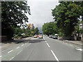
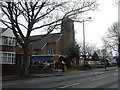
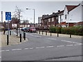
Photos of M16 0NY


Area Information
Living in M16 0NY offers a compact, residential experience within a small cluster of homes. With a population of 2,051, the area is characterised by a mature demographic, predominantly adults aged 30–64, many of whom own their homes. The proximity to major landmarks like Old Trafford and Firswood Station underscores its connectivity to both leisure and transport hubs. Residents benefit from a mix of retail options, including Tesco Stretford and Aldi White City Retail Park, while rail and metro stations provide easy access to Manchester and beyond. The area’s small size means it is ideal for those seeking a quiet, established community with minimal urban sprawl. However, its limited scale also means housing stock is finite, and buyers should consider proximity to larger centres for broader amenities. The blend of local convenience and regional accessibility makes M16 0NY a practical choice for commuters and families alike.
- Area Type
- Postcode
- Area Size
- Not available
- Population
- 2051
- Population Density
- 3073 people/km²
The property market in M16 0NY is defined by a 40% home ownership rate, with houses making up the majority of accommodation types. This suggests a small, established housing stock with limited new developments. The area’s compact size means buyers have fewer options, and properties are likely to be older, reflecting the median age of residents. While the low flood risk and lack of planning constraints indicate a stable environment for property investment, the high crime risk may deter some buyers. For those seeking a home, the focus is on existing houses rather than flats or newer builds. Given the area’s proximity to major transport links, it may appeal to commuters prioritising convenience over large-scale housing diversity. However, the limited size of M16 0NY means buyers should consider nearby areas for more choice.
House Prices in M16 0NY
Showing 15 properties
Energy Efficiency in M16 0NY
Daily life in M16 0NY is shaped by its proximity to retail, transport, and leisure hubs. The area’s five retail locations include major stores like Tesco Stretford and Aldi White City Retail Park, offering convenience for shopping and daily essentials. Nearby metro and rail stations, such as Trafford Bar and Firswood, connect residents to Old Trafford and Manchester’s cultural attractions. The presence of two airports, including Terminal Two Access, adds to the area’s appeal for frequent travellers. While the data does not specify parks or leisure facilities, the lack of protected natural areas suggests a focus on urban amenities. The combination of retail, transport, and regional connectivity creates a lifestyle that balances local convenience with access to larger urban opportunities.
Amenities
Schools
The nearest school to M16 0NY is Kings Road Primary School, which holds a ‘good’ Ofsted rating. As a primary school, it serves the local community’s younger population, though no secondary schools are listed in the data. The absence of secondary education options within the area means families may need to look further afield for comprehensive schooling. The presence of a well-rated primary school is a positive for families with young children, but the lack of secondary schools could be a drawback for those planning long-term residency. Parents should assess the catchment areas and transport links to nearby secondary schools, as the data does not specify their locations.
| Rank | School | Type | Entry gender | Ages |
|---|
Explore more schools in this area
Go to Schools tabDemographics
The community in M16 0NY is predominantly middle-aged, with a median age of 47 and 40% of residents owning their homes. The most common age range is 30–64, suggesting a stable, settled population. Accommodation is primarily houses, reflecting a traditional housing stock. The predominant ethnic group is White, which aligns with broader regional trends. Home ownership at 40% indicates a mix of owner-occupied properties and rental units, though the exact proportion of renters is not specified. This demographic profile suggests a community focused on long-term stability, with fewer young families or transient populations. The absence of specific data on deprivation means quality of life factors like income levels or access to services remain unquantified, though the presence of good schools and transport links implies reasonable infrastructure.
Household Size
Accommodation Type
Tenure
Ethnic Group
Religion
Household Composition
Age
Household Deprivation
NS-SEC
Explore more demographic insights in this area
Go to Demographics tabPlanning
Planning Constraints
- Flood RiskPremium
- Ramsar Wetland SitesPremium
- Area of Outstanding Natural BeautyPremium
- Protected Nature ReservePremium
- Protected WoodlandPremium