Area Overview for M15 5RG
Photos of M15 5RG
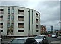
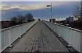
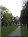
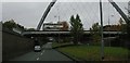
100 photos from this area
Area Information
Key information about the M15 5RG including its size, population, and administrative classification.
- Area Type
- Postcode
- Area Size
- 1.2 hectares
- Population
- 2389
- Population Density
- 9979 people/km²
House Prices in M15 5RG
30
Properties
£104,125
Average Sold Price
£68,500
Lowest Price
£135,000
Highest Price
Showing 30 properties
| Address | Type | Beds | Baths | Last Sale Price | Last Sale Date | |
|---|---|---|---|---|---|---|
| 26 Old Birley Street, Manchester, M15 5RG | Flat | - | - | £135,000 | Apr 2021 | |
| 24 Old Birley Street, Manchester, M15 5RG | Flat | - | - | £135,000 | Dec 2019 | |
| 20 Old Birley Street, Manchester, M15 5RG | Flat | - | - | £108,000 | Jun 2017 | |
| 14 Old Birley Street, Manchester, M15 5RG | Flat | 2 | 1 | £110,000 | Apr 2016 | |
| 22 Old Birley Street, Manchester, M15 5RG | Flat | - | - | £114,500 | May 2014 | |
| 4 Old Birley Street, Manchester, M15 5RG | Flat | 2 | 1 | £92,000 | Dec 2011 | |
| 16 Old Birley Street, Manchester, M15 5RG | Flat | - | - | £115,000 | Feb 2010 | |
| 6 Old Birley Street, Manchester, M15 5RG | Flat | 2 | 1 | £107,000 | Jun 2004 | |
| 18 Old Birley Street, Manchester, M15 5RG | Flat | 3 | 1 | £112,500 | Sep 2003 | |
| 8 Old Birley Street, Manchester, M15 5RG | Flat | 2 | - | £68,500 | Jul 2001 |
Page 1 of 3
Energy Efficiency in M15 5RG
Amenities
Schools
| Rank | School | Type | Entry gender | Ages |
|---|
Explore more schools in this area
Go to Schools tabDemographics
Household Size
Family (3-5 people)
most common
Accommodation Type
Houses
most common
Tenure
29
majority
Ethnic Group
White
most common
Religion
N/A
most common
Household Composition
N/A
most common
Age
22
median
Adults (30-64 years)
most common
Household Deprivation
N/A
with no deprivation
NS-SEC
31
in Lower managerial occupations
Explore more demographic insights in this area
Go to Demographics tabPlanning
Planning Constraints
- Flood RiskPremium
- Ramsar Wetland SitesPremium
- Area of Outstanding Natural BeautyPremium
- Protected Nature ReservePremium
- Protected WoodlandPremium